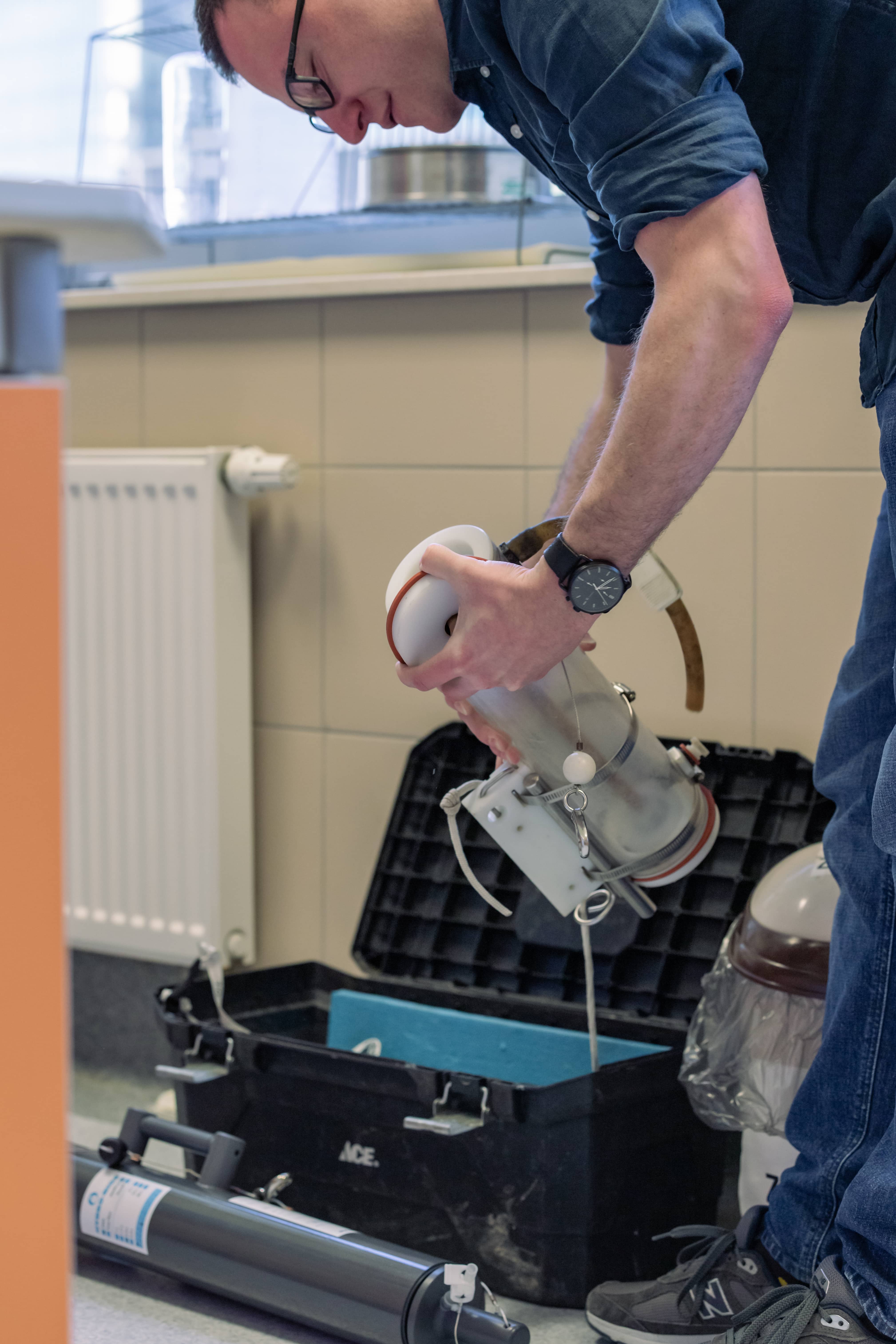
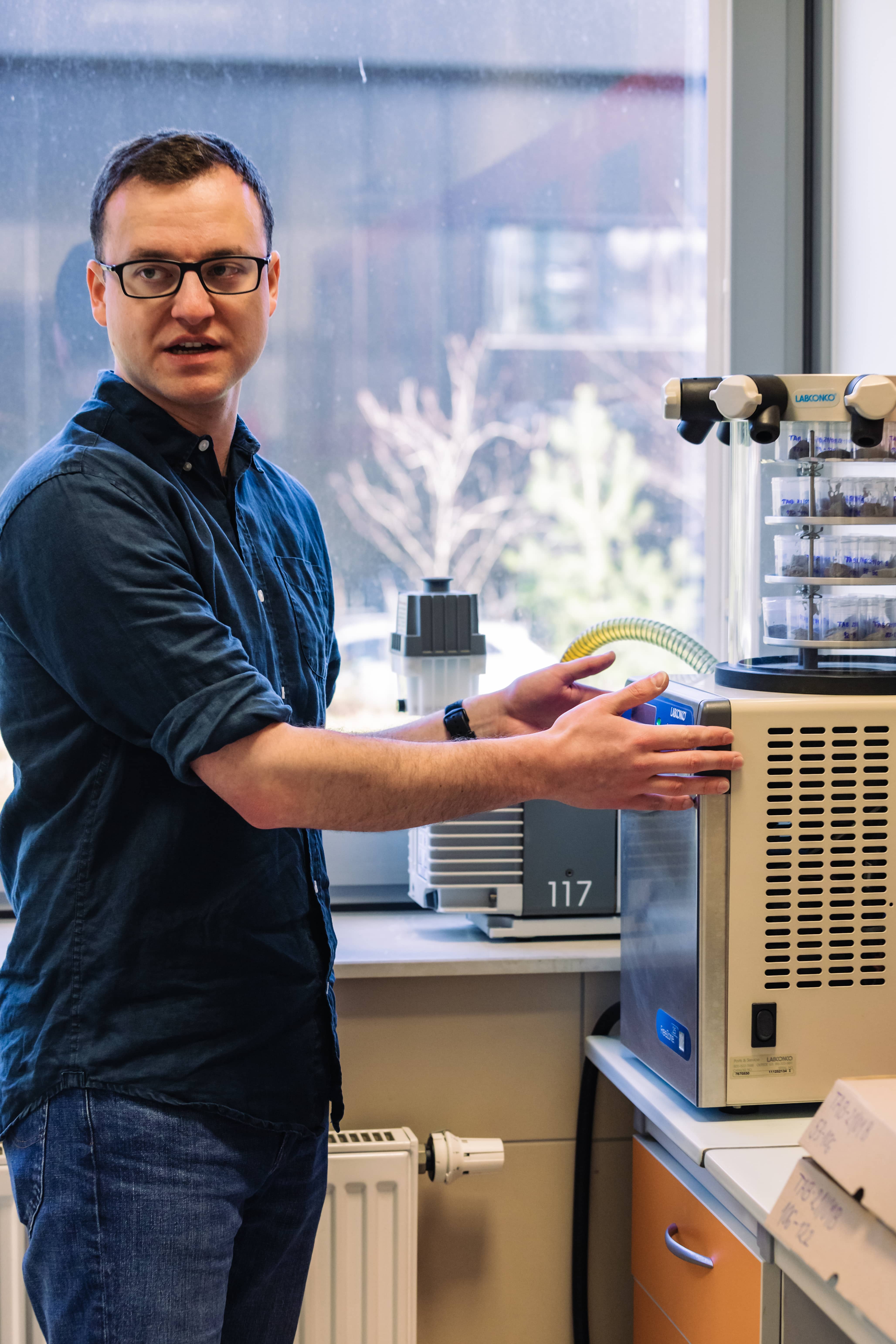
The photo shows dr Maurycy Żarczyński programming an automatic sedimentation trap.
The geographical environment is constantly changing. What influence did our ancestors have on it? Is it possible to know millions of years of the Earth's history which is not described anywhere? Or can we predict in which direction catastrophic processes caused by climate change will develop? I talk about it with dr Maurycy Żarczyński, a palaeolimnologist from the Reconstruction of Environmental Changes Team at the Faculty of Oceanography and Geography, University of Gdańsk, who studies and reconstructs past environmental changes based on lake bottom sediments.
- Elżbieta Michalak-Witkowska: You are a geomorphologist, or more precisely a palaeolimnologist. You research environmental changes in the past that can be reconstructed based on analyses of lake sediments. Please tell us about it, forgetting for a moment all the scientific terminology and nomenclature. What exactly and for what purpose do you study?
- Dr Maurycy Żarczyński: I mainly deal with what is created in the lake or goes into it. Lakes are home to numerous plants and animals, from tiny to quite large, which one day die and sink to the bottom. The same happens with minerals and chemical compounds, including pollutants. This is how lake sediment, which we also call gyttja, is formed. And it is these sediments that I study. The properties of sediments reflect the conditions of their formation. They are influenced by the state of the atmosphere (e.g. air temperature), the conditions in the water and the lake environment. Besides, all living organisms have their own 'preferences', much of which we know. Similarly, different processes influence the chemical compounds and minerals that make up the sediment. This allows us to read the past.
It is worth noting that all the matter that falls to the bottom of the lake gives us an incredible amount of information. Take, for example, diatoms, which are single-celled algae. When they die, knowing that the selected species of diatoms prefers to have a water temperature between 20 and 22 degrees Celsius in summer, we can, after examining the lake sediment, estimate the temperature many thousands of years back. Of course, such an analysis is never carried out based on a single genus and species of organisms. Looking too narrowly is asking for abuse. We can also observe, for example, the influence of air temperature and wind speed on the formation and behaviour of minerals in sediments. On the one hand, there are dozens of dependencies that we can name and we know how they affect what happens in the water and then in the sediment. On the other hand, many other relationships we are only trying to discover.
- Does sediment from the bottom of a lake say something about environmental and climate change?
- Very much. So much is changing now, especially with climate. We will experience the consequences of this more and more. Many more problems will affect us, many more phenomena will be catastrophic for us. This is due to the excess energy that is entering the Earth's climate system, which is being dealt with in ways that can be harmful to humans. Therefore, many catastrophic processes that used to occur less frequently, such as hurricanes and tornadoes, will occur more rapidly and more often. We want to forecast in which direction this will develop.
But to know what will happen in the future, we need to know what it used to be like. And this is what we - the people involved in palaeogeography - do, among other things. Based on our data, the so-called paleoenvironmental data, climatologists or atmospheric physicists model the future behaviour of the atmosphere and obtain a longer, broader context and new information for their research. By referring to the past, these data allow them to understand how our world's environment has changed and how today's society must prepare for the coming changes. This is just one example of how our results are being used.
- What you mentioned sounds worrying. I have the impression that, despite the seriousness of the topic, the problem of progressive climate change is still downplayed by some people. You've probably heard the 'argument' more than once that the climate has been changing forever and it's nothing unusual. Perhaps it is time to bury it?
- In the past the climate was changing too, that's a fact, but more importantly, it was changing for different reasons - natural reasons. And that is the fundamental difference. We have a great deal of data on what happened in the past, and with it, we can say in what direction the climate should now be changing. This clearly shows that today it is unfortunately man who is influencing the direction of these changes.
Part of the latest, sixth report of the Intergovernmental Panel on Climate Change (IPCC) ends with a paragraph that sums it up perfectly: 'The scientific evidence is unequivocal: climate change is a threat to human well-being and the health of the planet. Any further delay in concerted global action will miss a brief and rapidly closing window to secure a livable future.'
- The research you do also shows if and how much humans affect the environment and ecosystem?
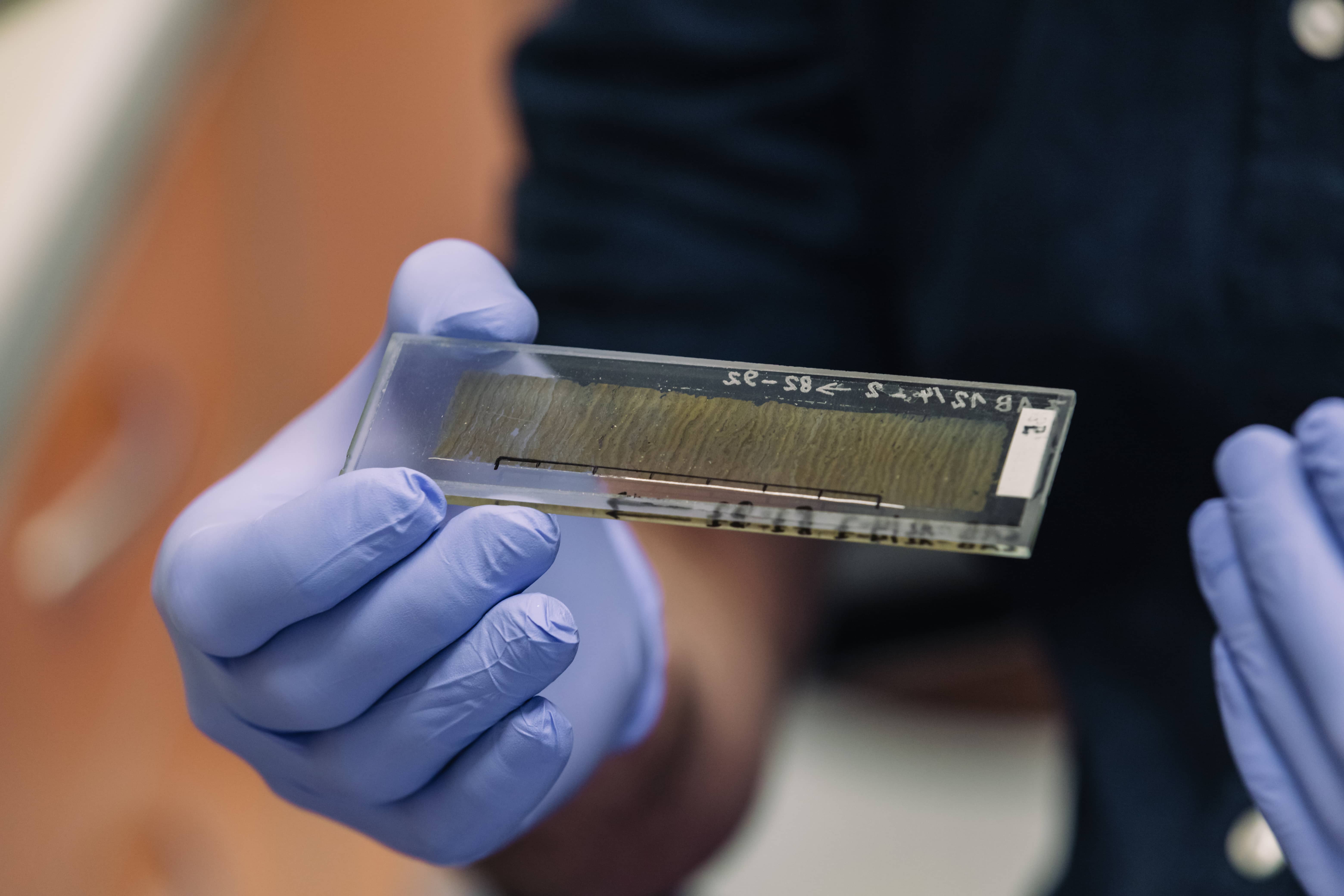
- Yes. The most interesting, in my opinion, is the work we do based on the analysis of varve sediments. These are fine structures characterised by alternating layers - we call them laminae. In our lakes, these are mostly light layers that form in spring and summer, and dark layers that form in the second half of the year, in autumn and winter. They are formed based on annual growth, analogous to tree rings. They are one of the most accurate archives of past environmental changes because by counting the layers of sediments one can go back in time with great precision and read even the most subtle information about the environment from hundreds and thousands of years ago.
Varved sediments are peculiar in that to be formed there must be a distinct seasonal variation in the environment, for example in air temperature. The seasonal rhythm of processes and phenomena results in the formation of layers. But this is not the only condition. Lakes must also be deep enough and reasonably well sheltered, for example by the surrounding forest. This prevents the water in the lake from mixing at the bottom. And that's important because there must be no oxygen at the bottom for at least part of the year - because that would mean life, and if there is life, then the delicate structure formed at the bottom is destroyed.
Some lakes can be naturally anaerobic during their development and in these lakes, the layers can preserve themselves without human intervention. This is important, anaerobic conditions are not always the result of human activity. Unfortunately, we observe that anaerobic conditions have started to develop in the waters near the bottoms of many lakes in Poland. On a larger scale, this began to happen around 100-150 years ago, corresponding to increased human activity in the area. The same process can also be seen globally. And this is just one of the many examples of human activity that we can study.
- Are you saying that man-caused this oxygen desert in the lake?
I will answer using the example of three varve lakes from the north of our country, near Grudziądz, Drawsko Pomorskie and Bydgoszcz. The research was led by colleagues from our Team. Strong reactions of the lakes to human activities took place there in the period shortly before and after both world wars, when there were agricultural reforms, increased fertilisation of fields and so on. These lakes reacted instantaneously - when nutrients were supplied, they started to live very intensively (algae, cyanobacteria etc. multiplied). When the matter died, oxygen was consumed very quickly and an anaerobic environment was created. It was in this anaerobic environment that the layers began to behave. We can see that anaerobic conditions develop in our lakes, and economically and ecologically they are very unpleasant in their consequences, they can cause e.g. mass deaths of fish, domination of cyanobacteria and so on. This directly affects the condition of the lakes, threatens biodiversity and also means that the lakes cease to be attractive to tourists. So we have many traces of human activity, expressed in very different ways, but with far-reaching consequences.
- Analyses of the varved sediments also perfectly illustrate the fact that in your work you go beyond the boundaries of a single scientific discipline.
- Oh yes, we like to draw on historical sources when they are available. For example, information about agricultural practices, population censuses or pre- and post-war maps (although the problem with the latter is that the useful ones go back only a few centuries). We use, among others, post-German maps, because in the areas of northern Poland, where we often conduct our research, the German cartographic service prepared excellent materials. We compare the old map with the new one and see how e.g. the settlement, the road system and the river network developed.
In the Suwałki region, it was from maps that we learned that the course of one watercourse in the catchment area of a lake we were interested in had been significantly changed. Thanks to this we knew when, more or less, it happened and we could observe a similar response in the lake, as the nature of sediment started to change in it. The lake is responding to changes locally, regionally and globally. We can 'see' much of what has happened around a particular reservoir in the past. For example, agricultural development in a lake catchment is literally changing the vegeta cover. Therefore, although there are no written sources from thousands of years ago, from our research we can see where people were and what they were doing. We see human activity and can confront this with for example archaeological artefacts. In addition, we draw on the expertise of many sciences, chemistry, physics or biology. Mostly in collaboration with representatives of these professions.
- You mentioned that varve sediments are one of the most accurate methods of recording past environmental changes. Would you explain that a bit more?
- They simply give a perfect time scale because we can quantify it in calendar years. This allows us not only to reconstruct past environmental changes but also to test other dating methods. Already several years ago, the sediments of Żabiński Lake served to recognise the limitations of radiocarbon dating, which makes it possible to determine the age of plant and animal remains, or biogenic sediments, up to about 50,000 years ago. Recently, using an even longer core of sediments from this lake, we have tested a new technique of radiocarbon dating, using the so-called gas source, which allows for examining very small samples. In short, the method works well and offers a chance to determine the age of material that would be difficult to date using classical methods due to insufficient carbon. Small samples of material are a problem faced by many sciences.
The search for methods to determine age leads to extremely interesting discoveries. For example, volcanic glaze is sometimes found in lakes and sediments. If we identify such material and assign it to a particular volcano and eruption, we can determine very precisely when the sediment was formed. It also works the other way round, finding volcanic material in perfectly dated varve sediment allows us to precisely determine the age of a given eruption. This is extremely important in the case of eruptions that took place, for example, a thousand years ago. In Żabiński Lake we found traces of several such eruptions, material from Iceland, the Azores and even Alaska. Imagine that this fine dust flew across half the world and then fell into our lake. This gives us information about the age, but also about what the atmospheric circulation was like at that moment. The dust cloud spread with time and distance in a particular direction, which is also important information.
- I already know a lot about sediments, please tell me, how do you extract them from the bottom of the lake?
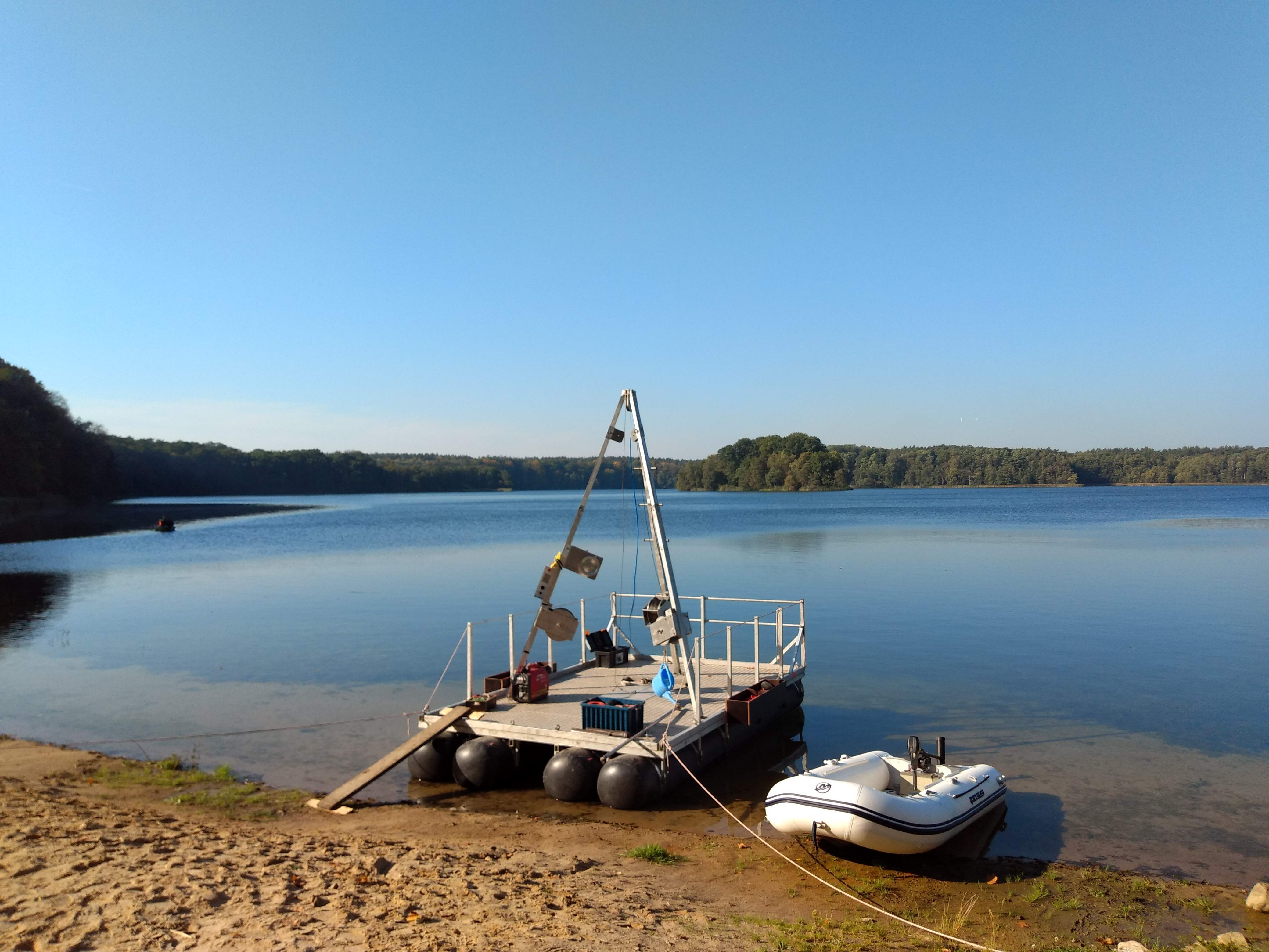
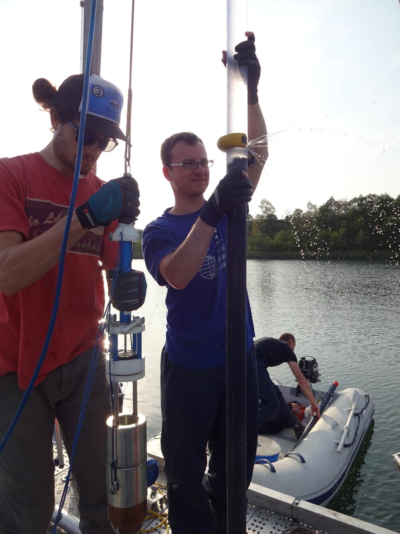
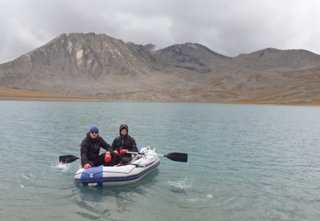
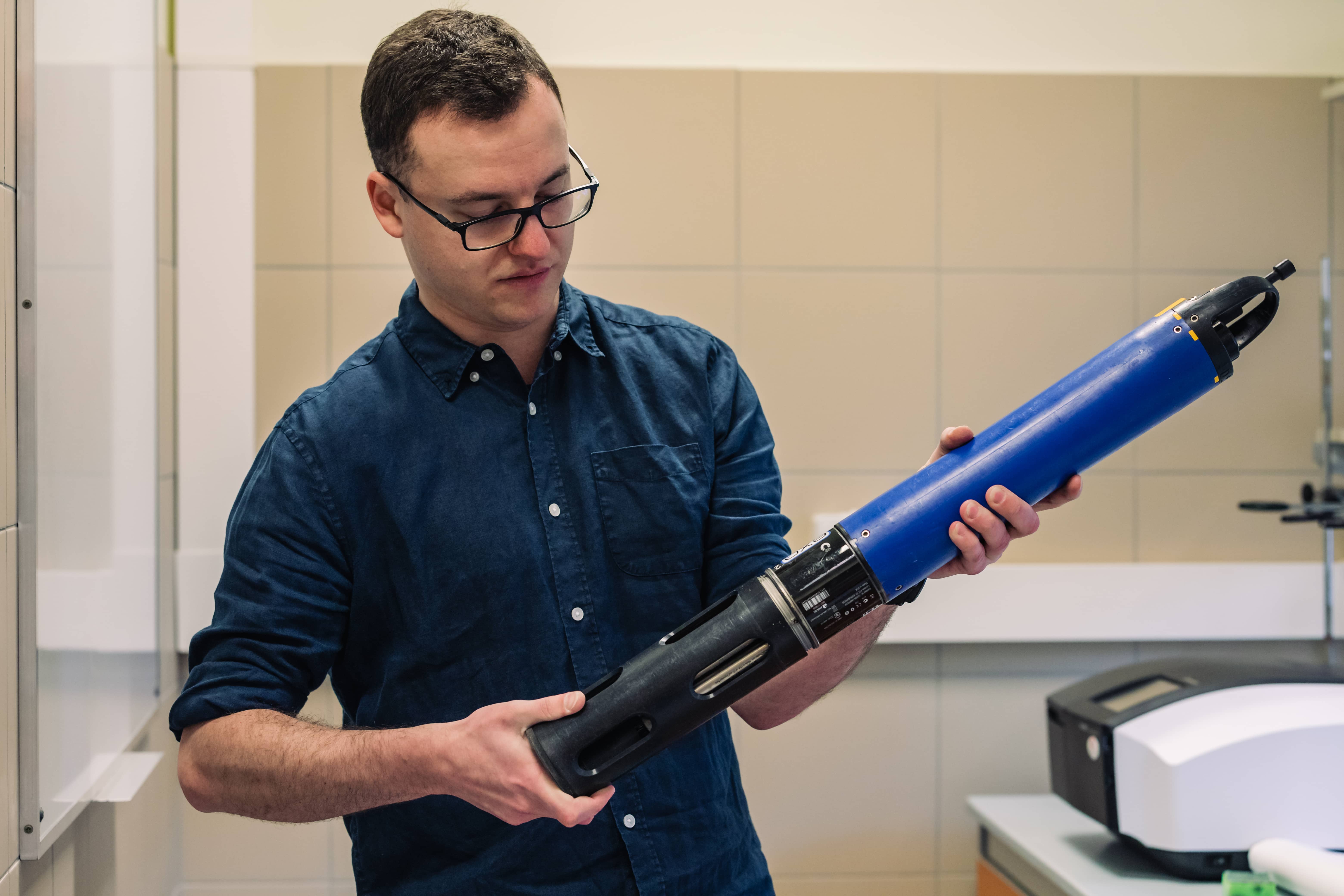
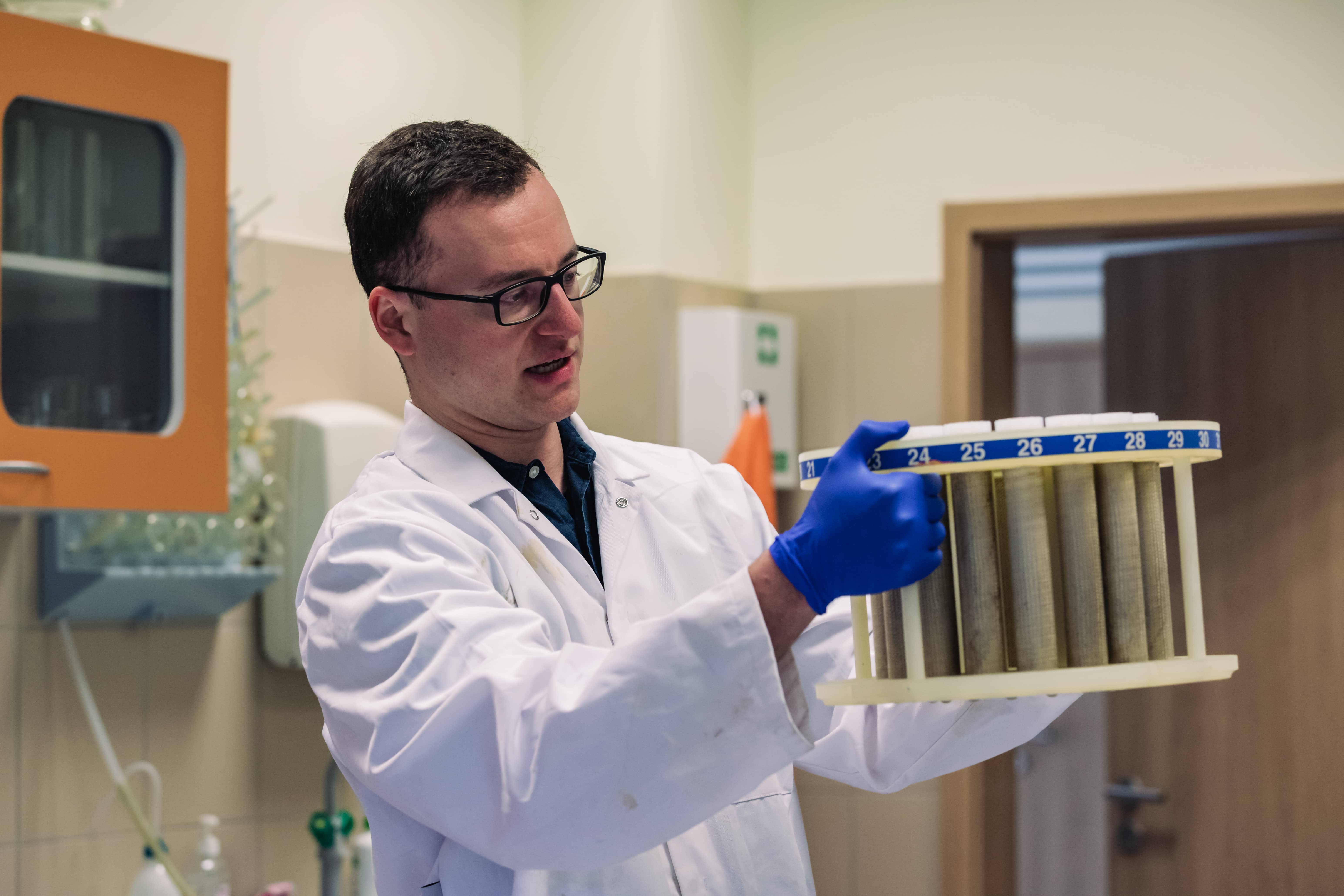
- Two to four people on one or two pontoons, go out into the middle of the lake and get to work. A pipe is put into the sampler, which is a metal and Teflon clamp, and this is lowered on ropes to the very bottom, where the pipe sinks into the sediment. We pull out the material collected in this way manually and very carefully. In doing so, we try to hold the sampler vertically so as not to disturb the water-sediment surface. With a core measuring three metres, this is quite difficult, especially when the wind is blowing - depending on the material and length, such a sampler with the sediment taken out can weigh several dozen kilos. A special platform is necessary to extract longer cores. We rent such equipment.
- Do you often go out on the lake? You drop off samplers, measure the properties of the water. Tell us something about this.
- We go out to the lakes we monitor on average once a month. We blow up the dinghy, load all the equipment into it (including a multi-parameter probe, a water sampler, a Secchi disk), go out and start the research (we measure the physical and chemical properties of the water, its temperature, oxygen concentration, how much chlorophyll there is, how many nutrients there are). We go out all year round, regardless of the season. In winter, of course, everything depends on whether there is ice, if it is thin you can't do anything. If the ice is thick enough, we conduct our research on foot, from the ice. The size of the lake is also important, as we first look for the deepest spot - sometimes it's 50m, 500m and sometimes over a kilometre from the shore. That's why we sometimes spend several hours on the dinghy. We sometimes work from dawn till dusk.
- Do you have any funny stories while working in the field? I'm guessing that more than one piece of equipment has been left at the bottom...
- We have various funny situations connected with local people. Most often when people see us they are convinced that we come to fish to catch them with electricity (laughs). They see the cables, the battery, all this equipment, so they ask: 'how are the fish?'. We try to answer with a smile, although after a whole day we are not always strong enough.
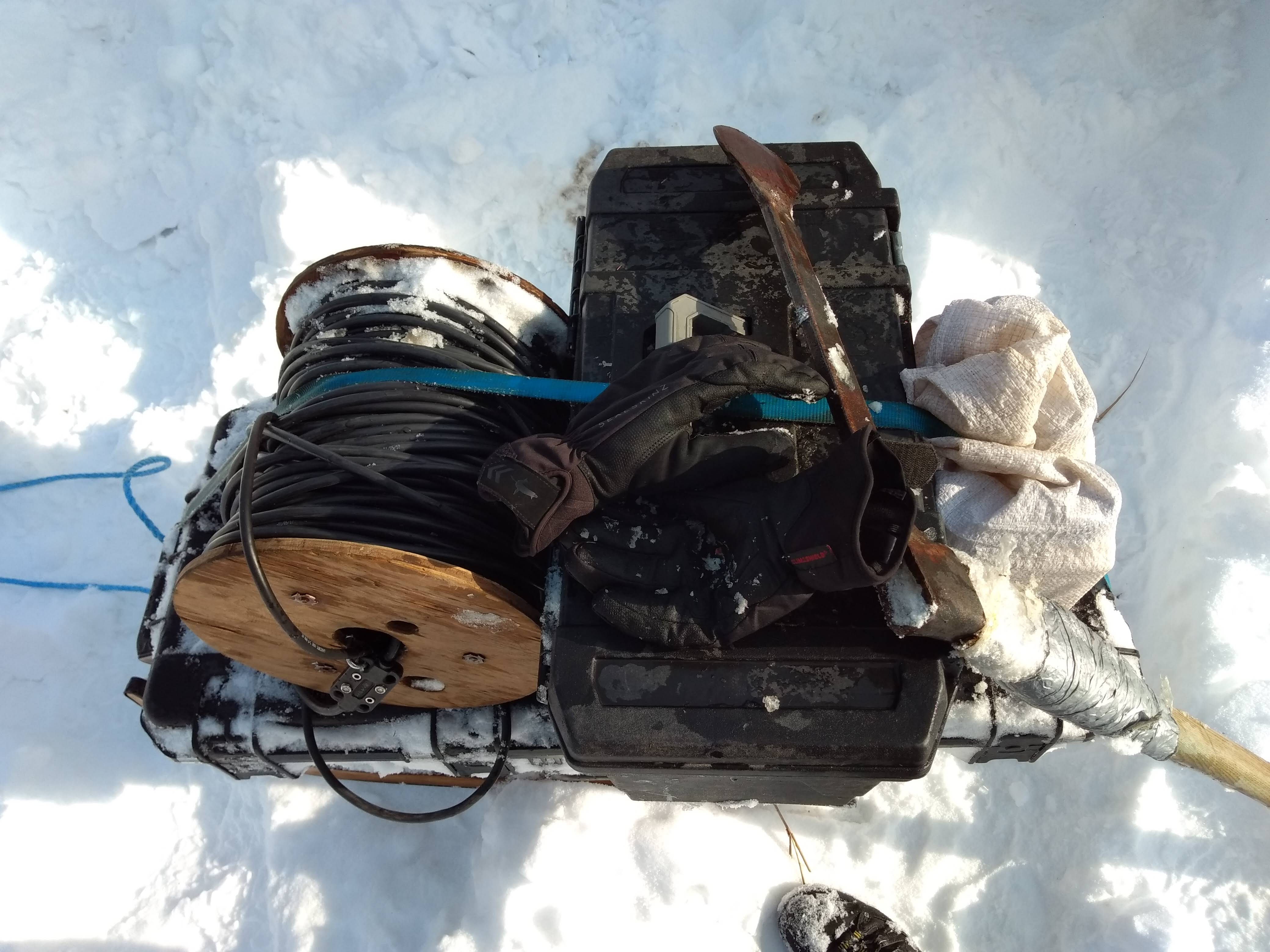
The stories with the equipment could be told for a long time. We have been doing this for years, it seems that we have everything organised on the dinghy down to the centimetre, but still everything gets tangled up. We've also drowned GPS units or lost the Secchi puck - it's not hard to do that in heavy weather, something can break, something can come off, in winter your hands lose all feeling. Although we try to secure the equipment carefully, we fasten it with ropes and carabiners, it is not always possible to save it.
There are also cases of theft - we have equipment that we leave in the lake, so-called sediment traps, which catch sediment for a certain period of time (these are pipes on a rope that are held vertically one metre above the bottom by a buoy). On one project we set up installations basically from one border to the other, across the whole of northern Poland, across 50 lakes. In the beginning, we had 50 traps, every year less and less. You see 50 metres of rope is a useful thing (smile).
- Where do you sleep? In tents or more civilized conditions?
- We have accommodation in very different places. Mostly in friendly quarters. But when we travel around Poland, we stay in hotels and hostels. Especially abroad, far away from civilisation, for example recently in the Caucasus, it was obviously an overnight stay under a tent.
While staying in lodgings, we experience unusual, famous Polish hospitality. People treat us with homemade products, homemade dinners, sometimes we are even offered to drink 'a double' together. I could not forget to mention scrambled eggs - a typical breakfast for the trip. We ate so many of them that it is impossible to count, with additions that would be hard to remember (laughs).
- What then, once you have the material collected? Does the lab work begin? Dry, warm, no wind (laughs).
- Yes, it's mostly dry in the lab. Mostly! Our work consists of two main stages. The first is fieldwork. This is collecting sediment and monitoring the lakes - we want to know how the lakes are functioning now, so we can translate what we read in the sediment to their past functioning. We check whether the water in the lake is mixed, whether it's rich in oxygen, in organic and biogenic compounds, what the water temperature is, whether the lake freezes or not, and so on. This is what we go to the field for regularly.
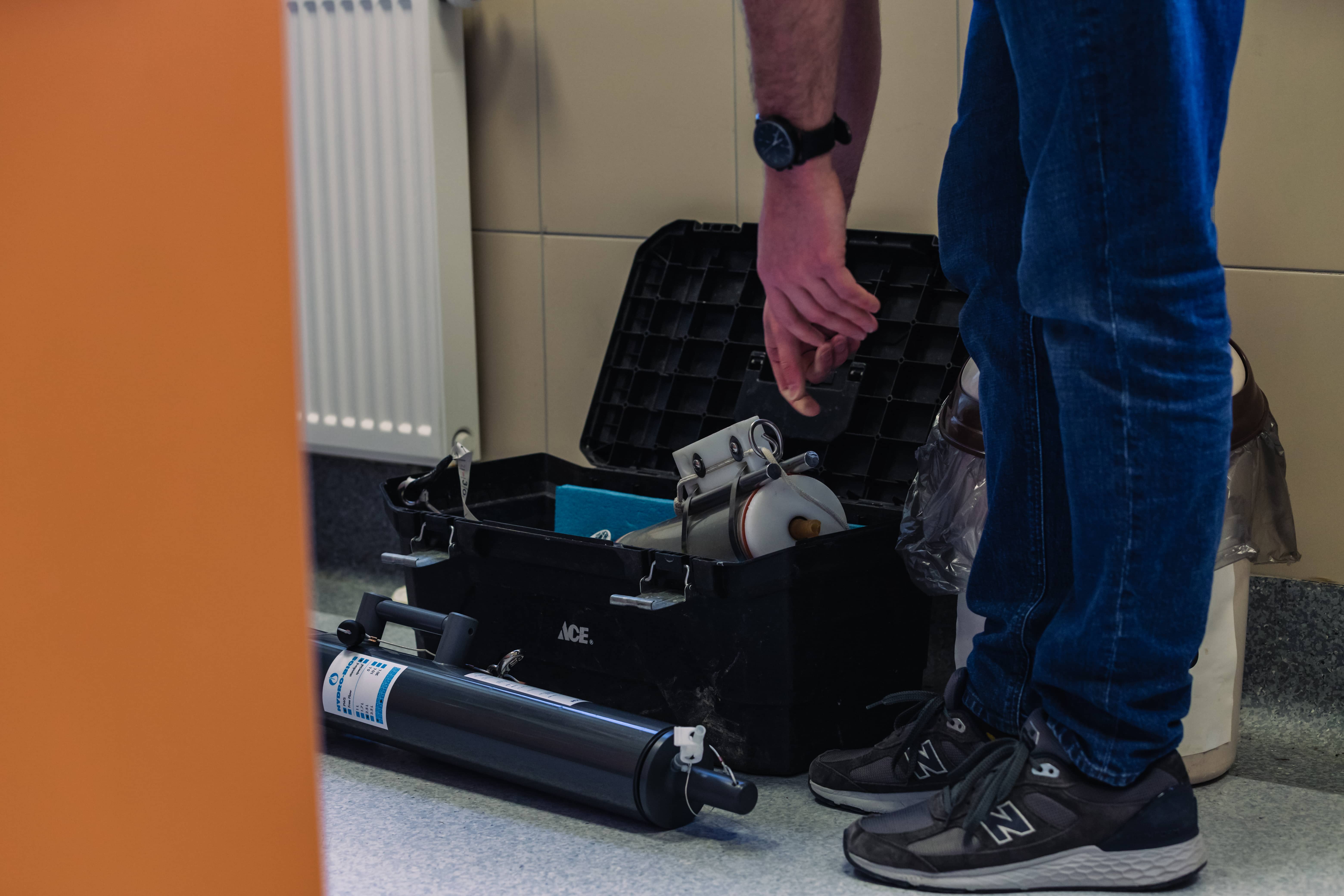
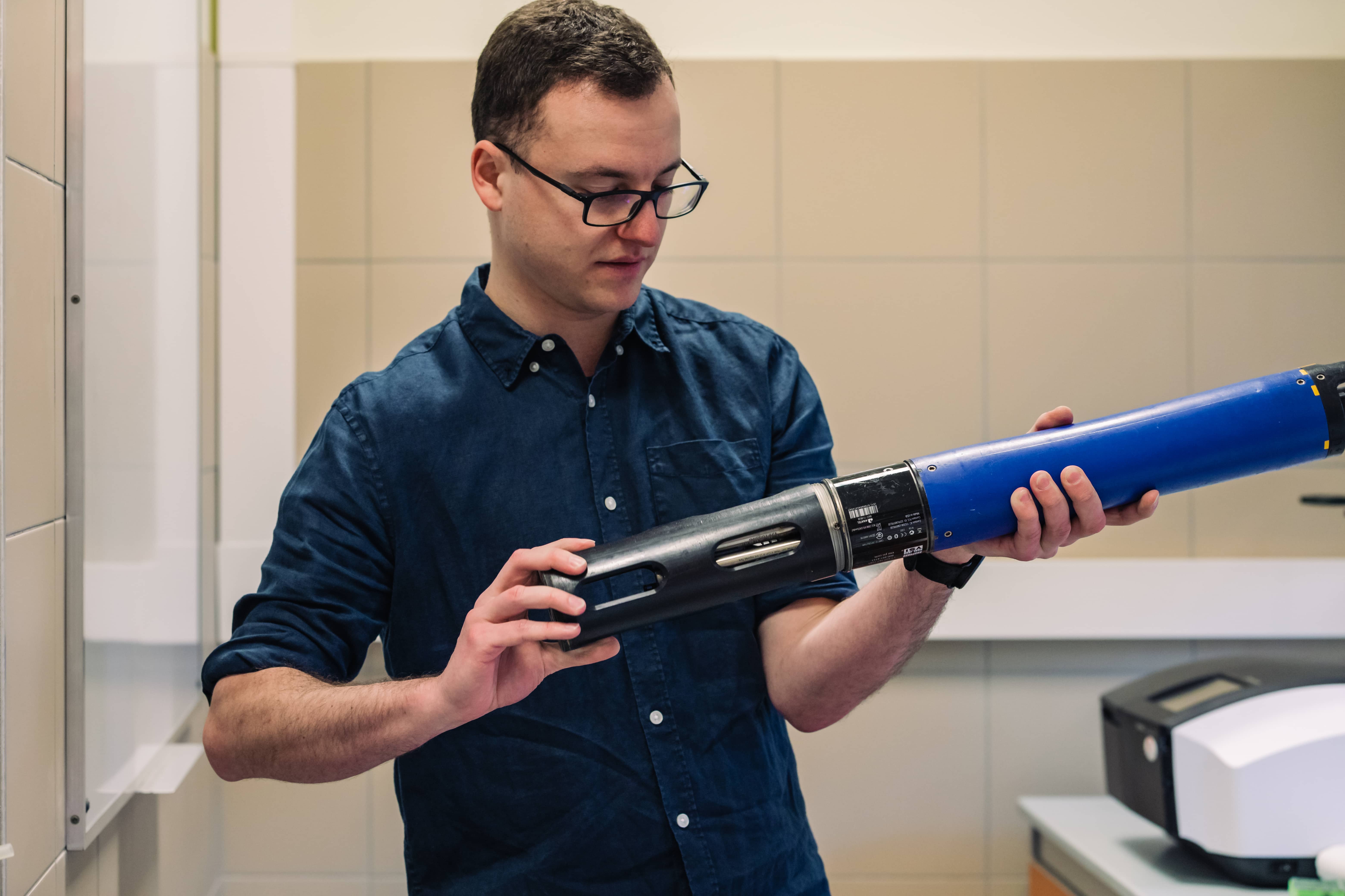
The second is core sampling in the laboratory.


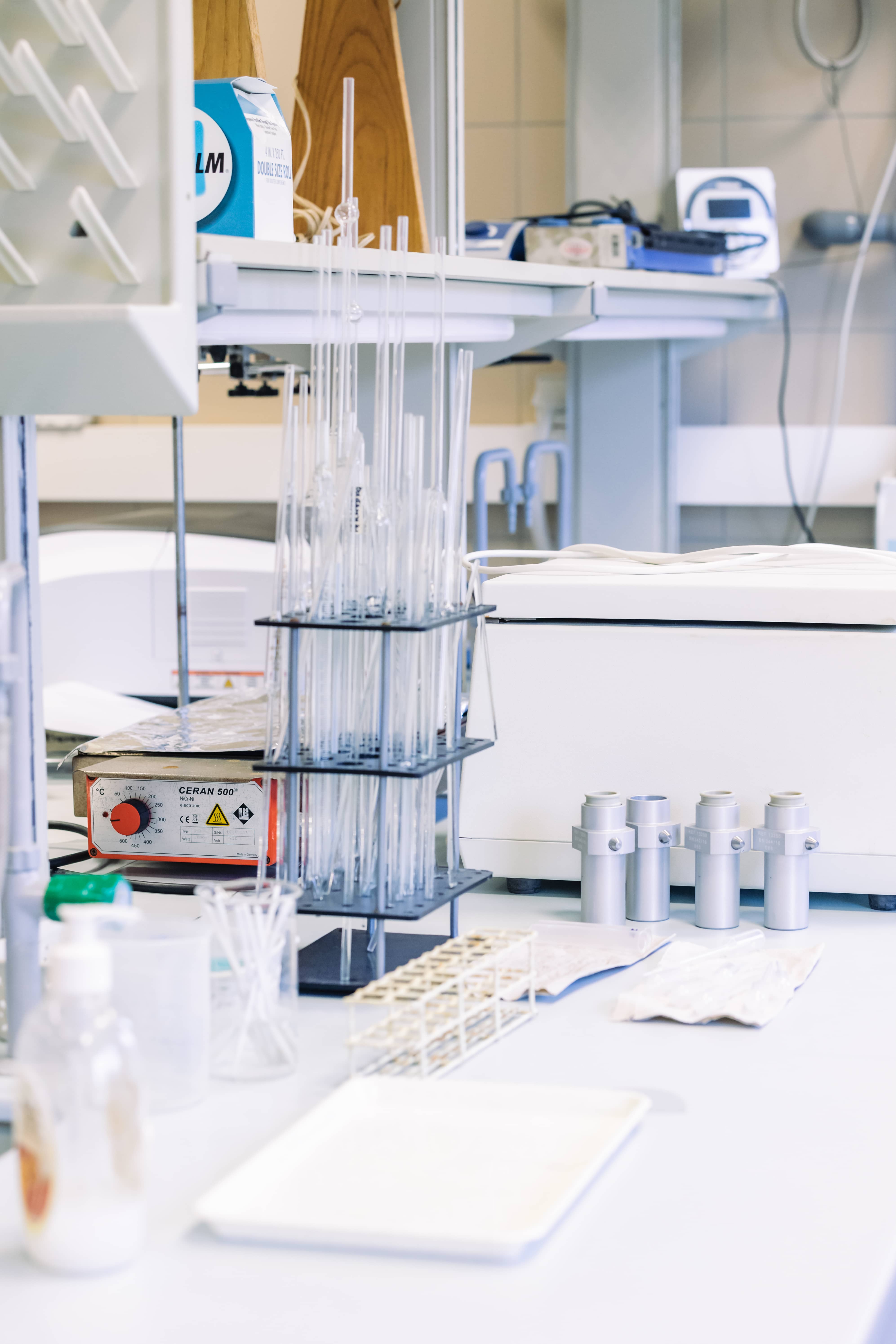
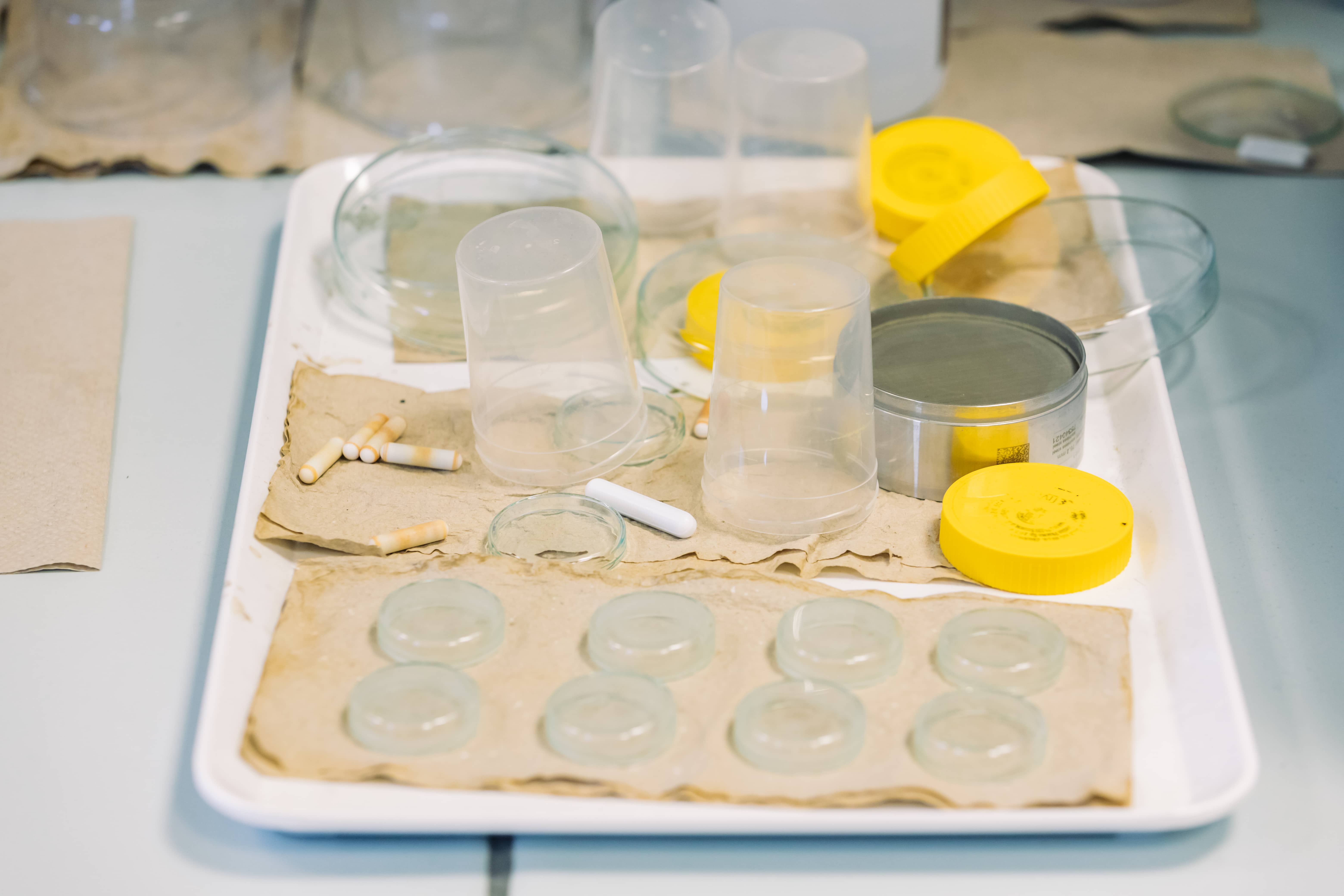

- How do you process the material collected? What equipment do you use for this?
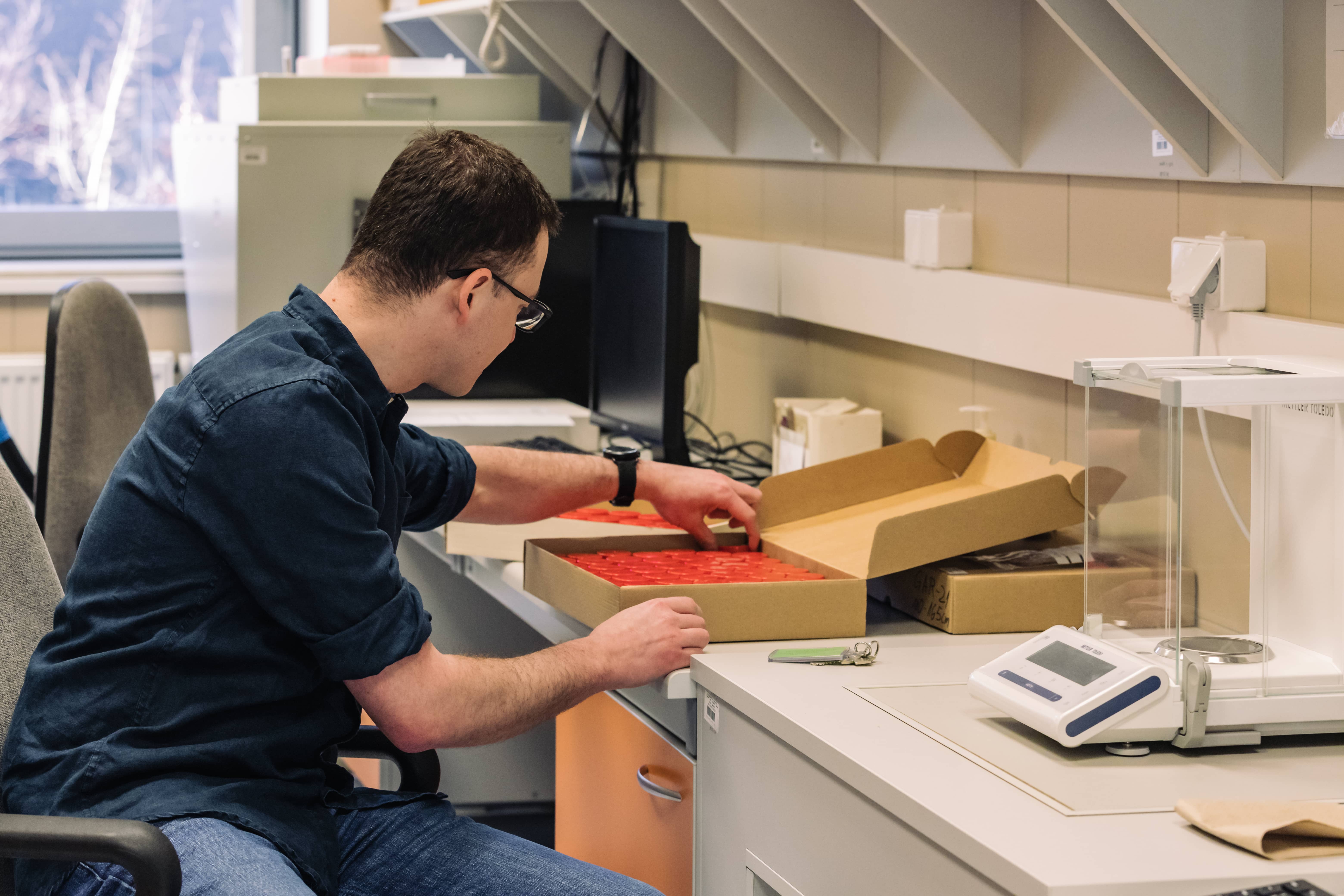
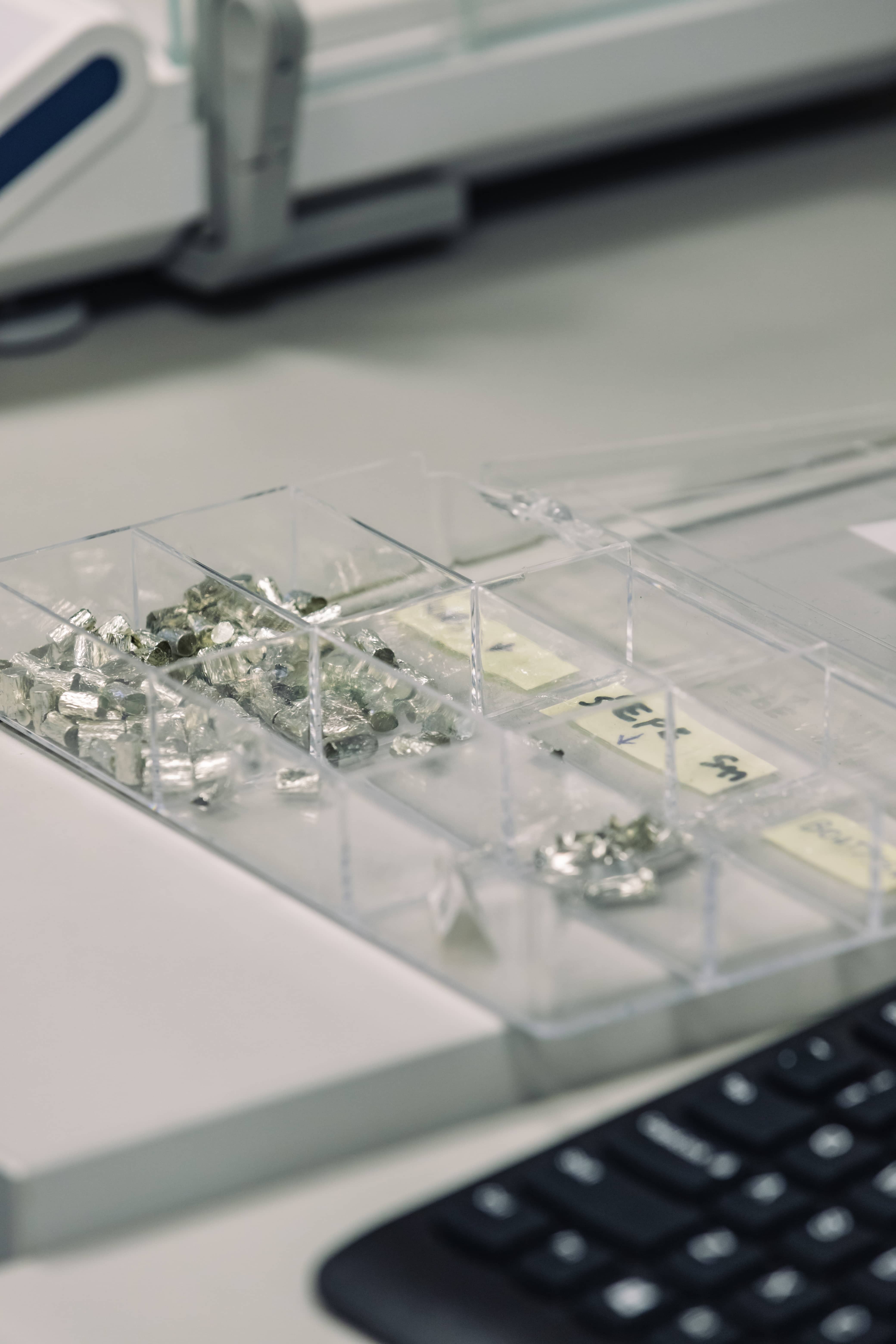
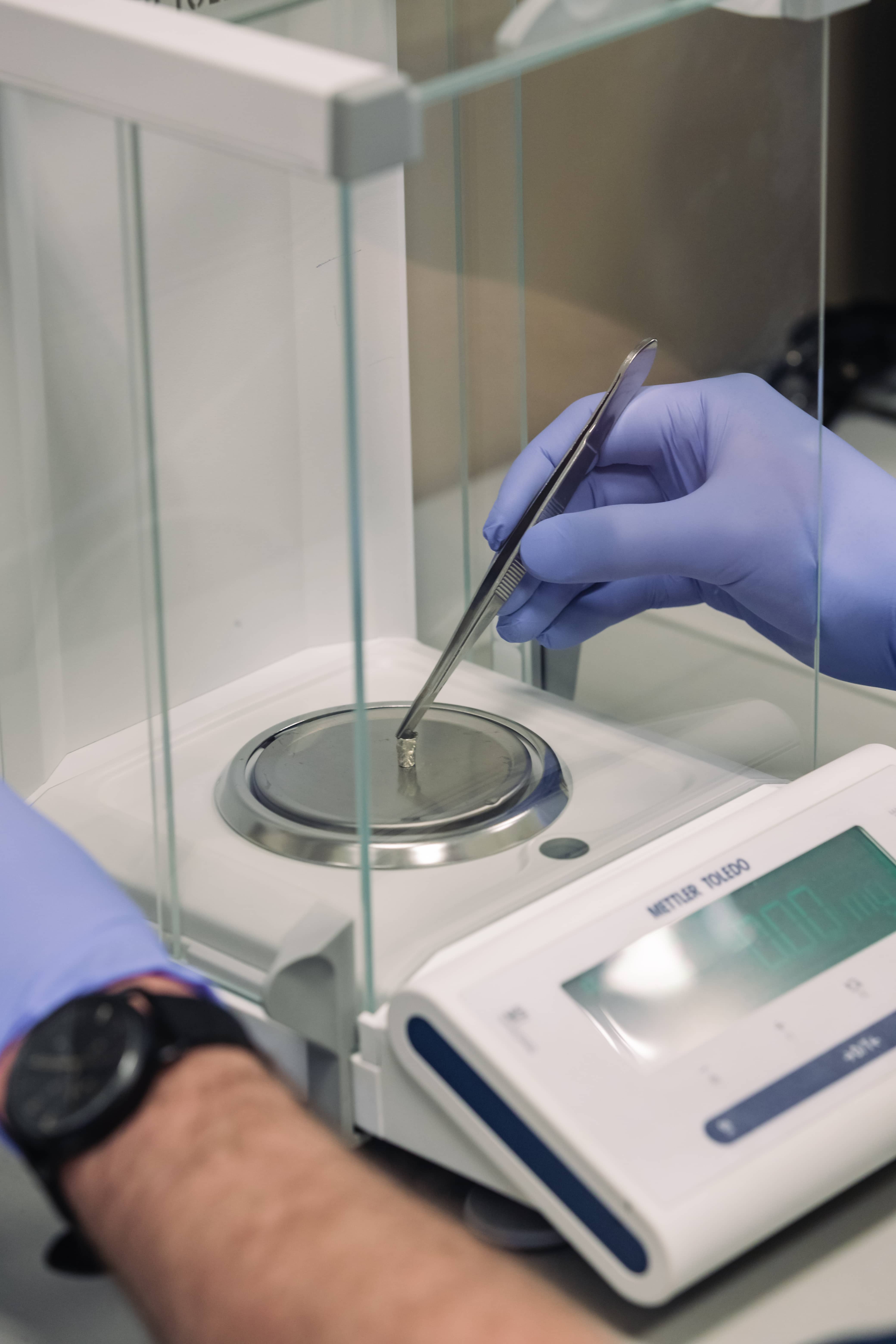
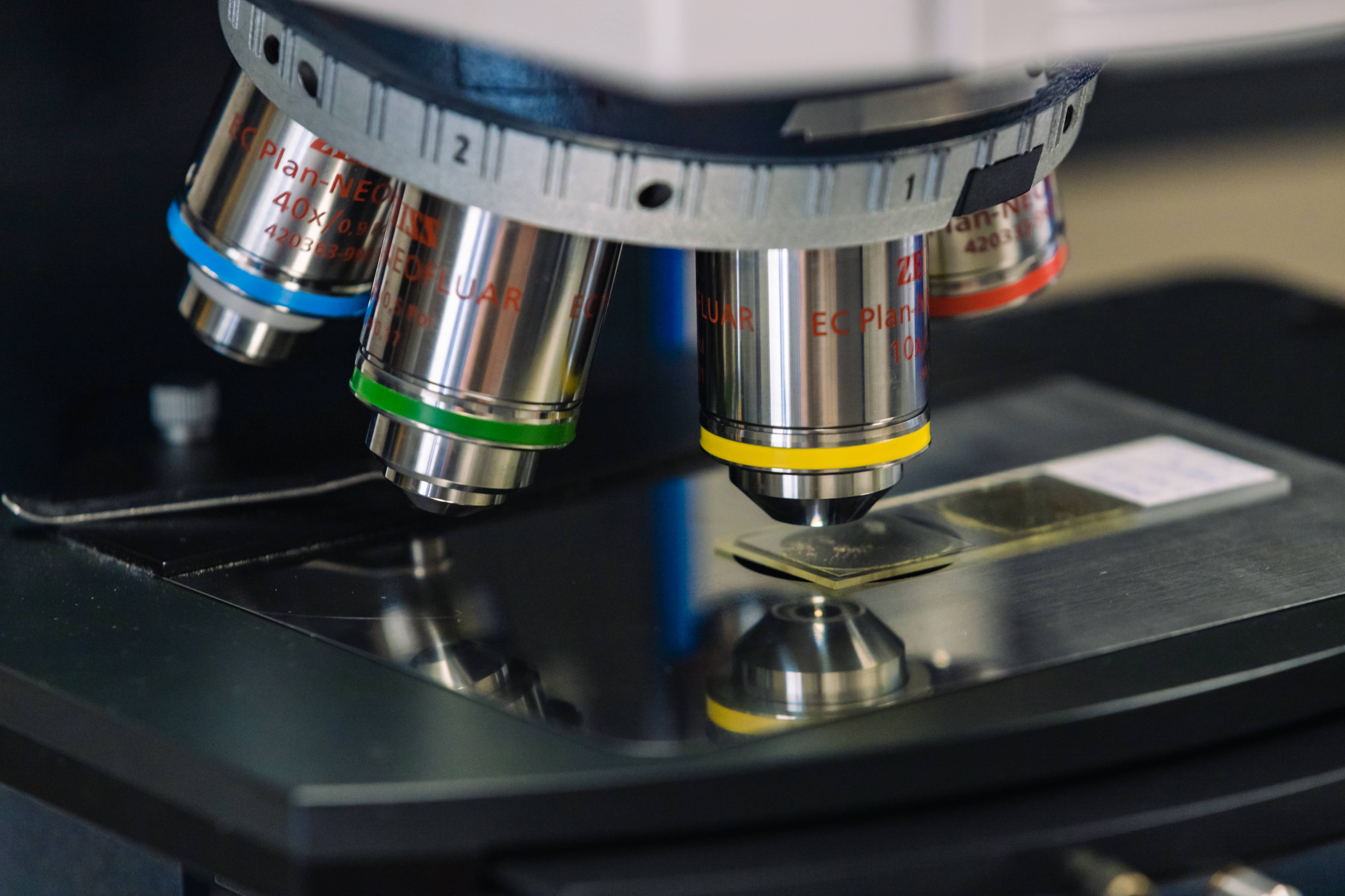
- First of all, we split the collected core lengthwise in half. One half is used for non-destructive analyses, in which we obtain information without losing material. The other half we divide for classical destructive methods (e.g. in the case of varved sediments we always do the so-called thin-slicing, we take out the monoliths to be able to make a permanent microscopic preparation, where the structure of the sediment is preserved). We sample part of the sediment, from which we come out with such basic things as the density of the sediment. Another part we dry, another part goes to analyses related to diatoms, other plankton groups and pollen. As I said, all this informs us about something.
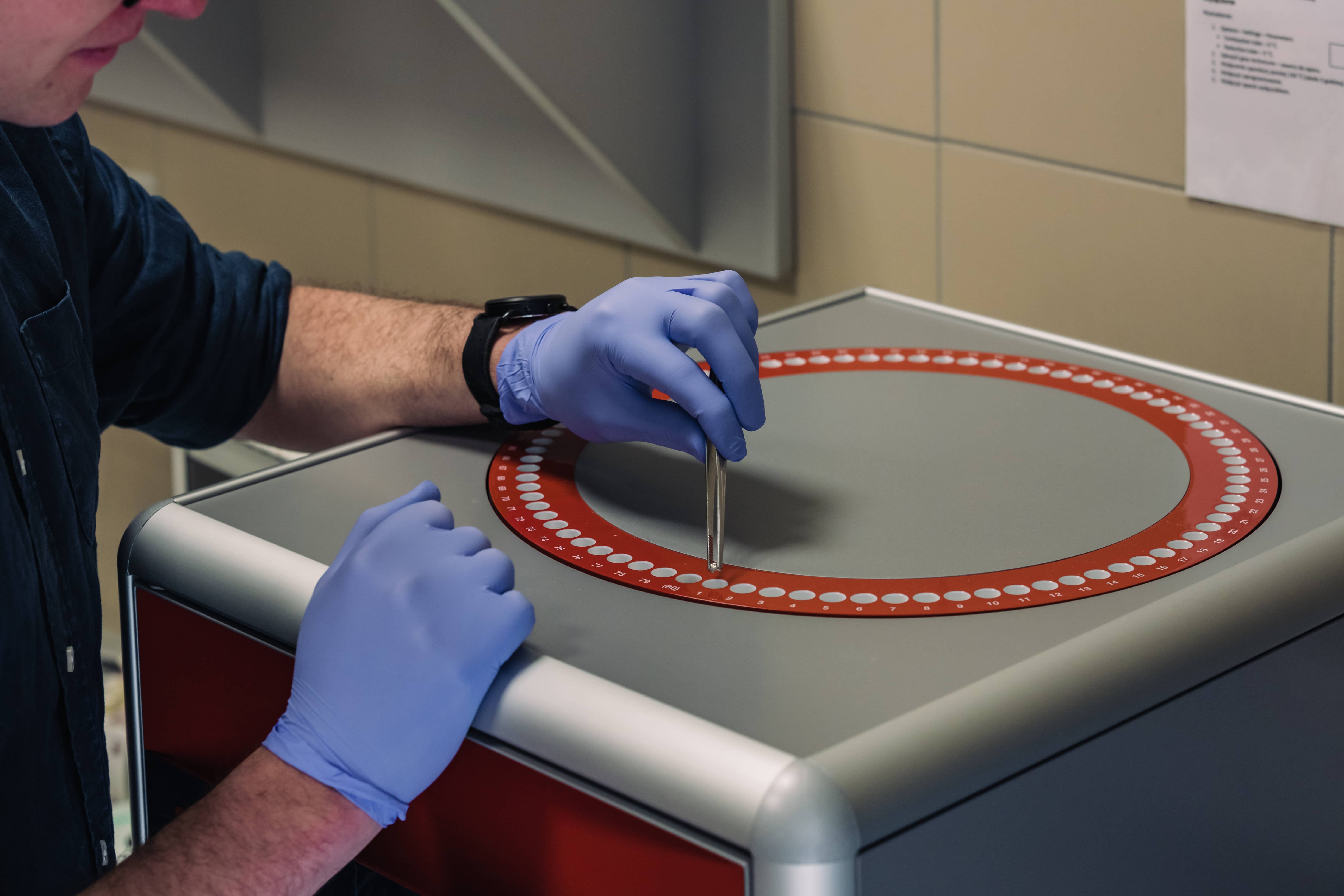
Personally, I focus mainly on what changes in the chemical composition of the sediment. For example, we measure organic and inorganic carbon, nitrogen and sulphur in collected samples (this is called elemental analysis), which tells us, among other things, how much organic matter there is in the sediment. We also scan sediments using modern techniques with interesting and not very meaningful abbreviations - µXRF (elements), HSI (pigments). We also deal with geochronology, i.e. working out the time scale. For example, some of the material goes into test tubes and a lead-lined gamma spectrometer, where each sample is measured around the clock (here we measure, among other things, the amount of radioactive caesium-137, an artificial element produced in large quantities by the man during nuclear tests and after the Chernobyl disaster).
We also use an alpha spectrometer on which lead dating is performed. With this method, we can determine sediment that is roughly 150 years old. In this way, we count how fast the sediment grew, which allows us to determine its age. Someone counts the layers under a microscope, we add caesium dating, lead dating, radiocarbon dating, and then we put all the data together: geochronological, ecological and geochemical proxy data - and then we try to find a common signal. Knowing how the lake functions, we try to put it all together and say what was happening in the area 100, 1000 or 10000 years ago.
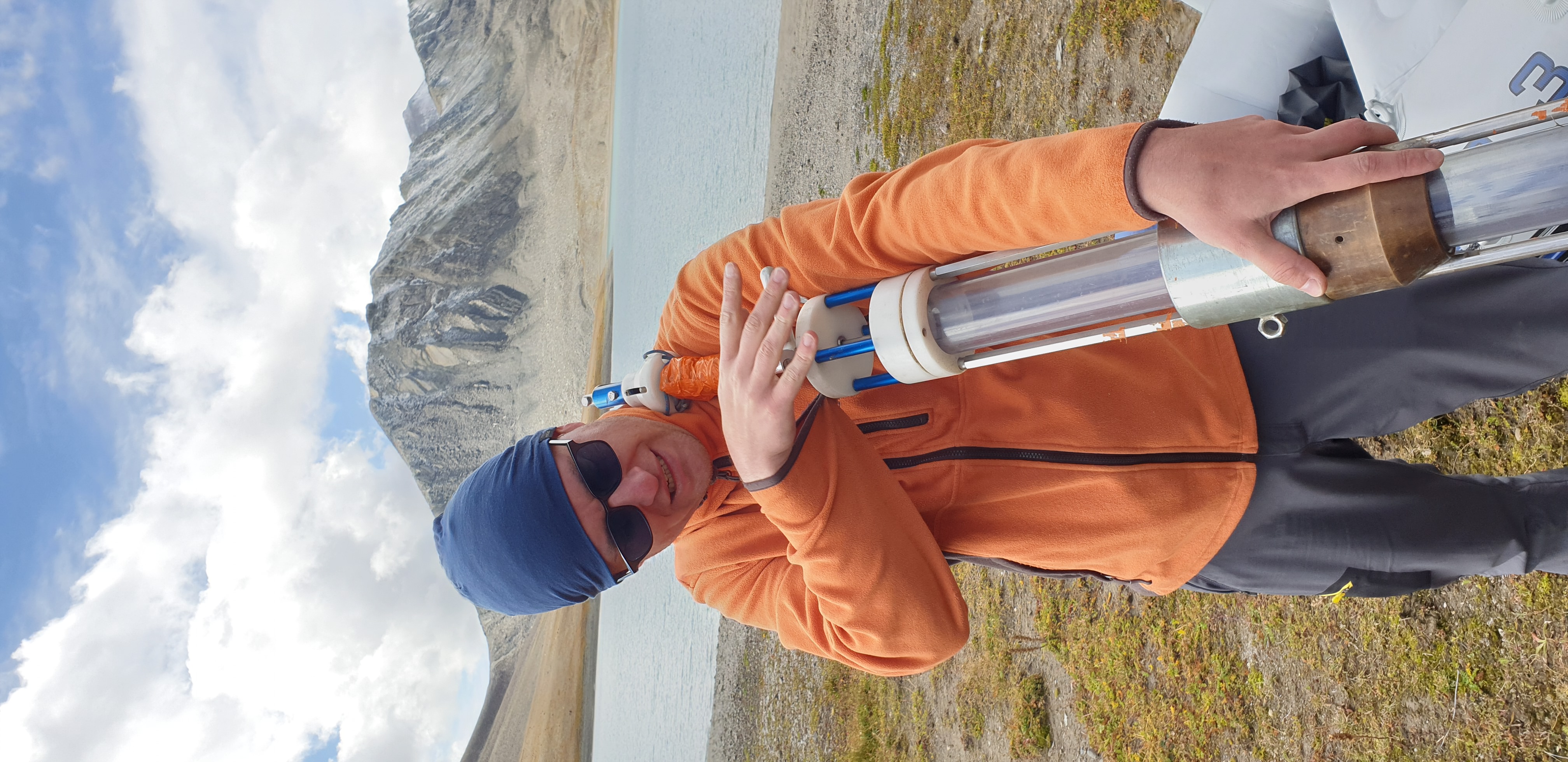
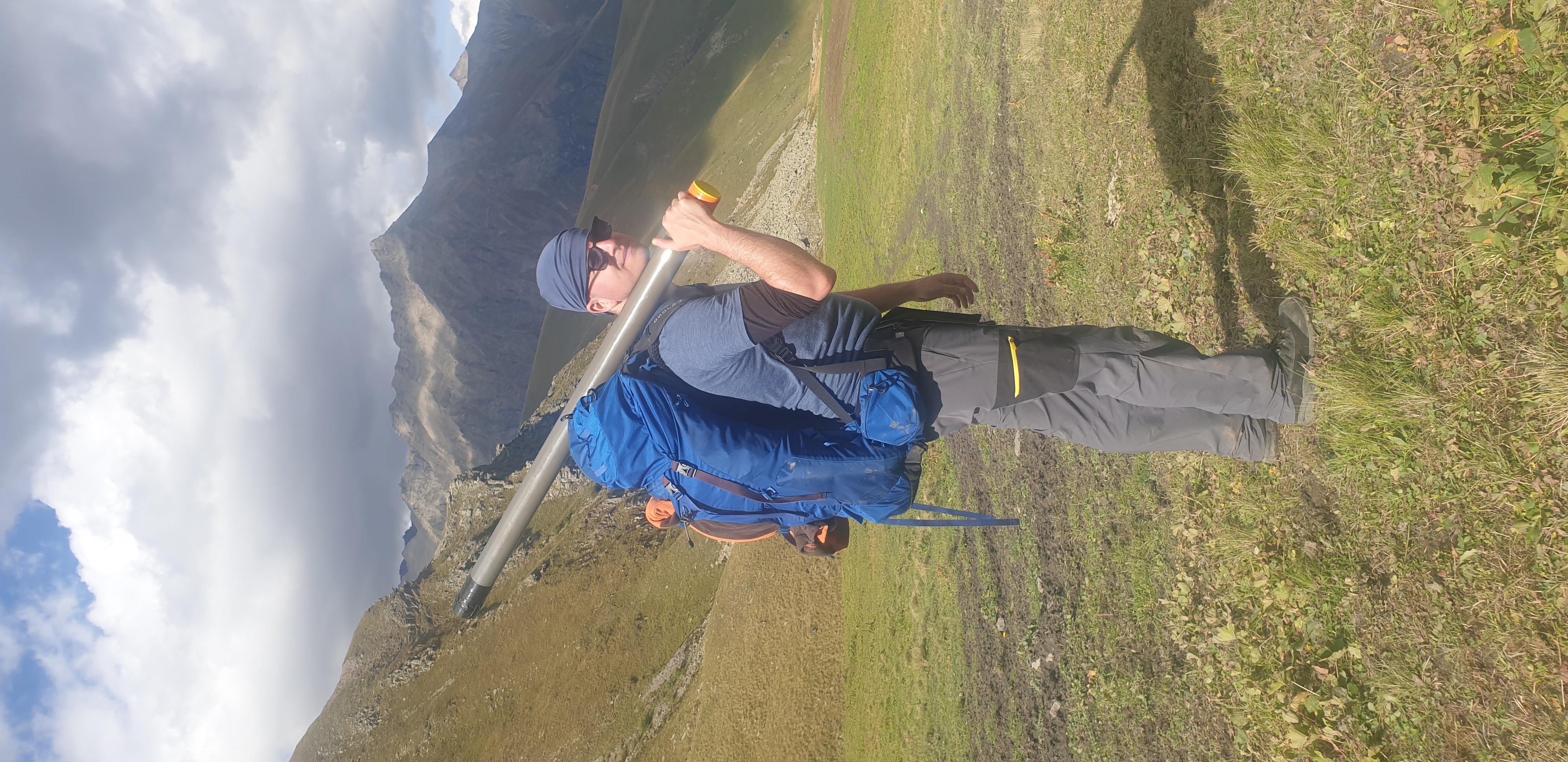
- Although the core of your research consists of the Polish lakes sediments, you are also involved in the study of material from other countries, most recently you participated in the study of material from Georgia. You are now about to embark on another great adventure and travel to the USA - you have been awarded a scholarship from the Bekker Program (NAWA), thanks to which during your 18-month internship you will work on material from Lake Stoneman, located in Arizona, which records nearly 1.3 million years of Earth history.
- We brought the material from Georgia to Poland in September. With considerable effort, we collected sediment cores of two lakes in the Caucasus. At the moment we are doing the first analyses. I have an impression that they can give really interesting results.
As for the Bekker scholarship, yes, I will leave in April, or at least I hope so. The project I will be doing is entitled 'Reconstructing environmental changes in the glacial-interglacial cycle over the last 1.3 million years recorded in the sediments of Lake Stoneman (Arizona, USA): a cutting-edge approach using hyperspectral imaging.'
The internship will take place at Northern Arizona University in Flagstaff (USA). My supervisor on the NAU side will be one of the leaders in international palaeoclimatology research, Professor Darrell Kaufman. I was very fortunate to have been able to meet the professor several years ago. Thanks to his invitation and willingness to collaborate, it was possible to obtain a fellowship.
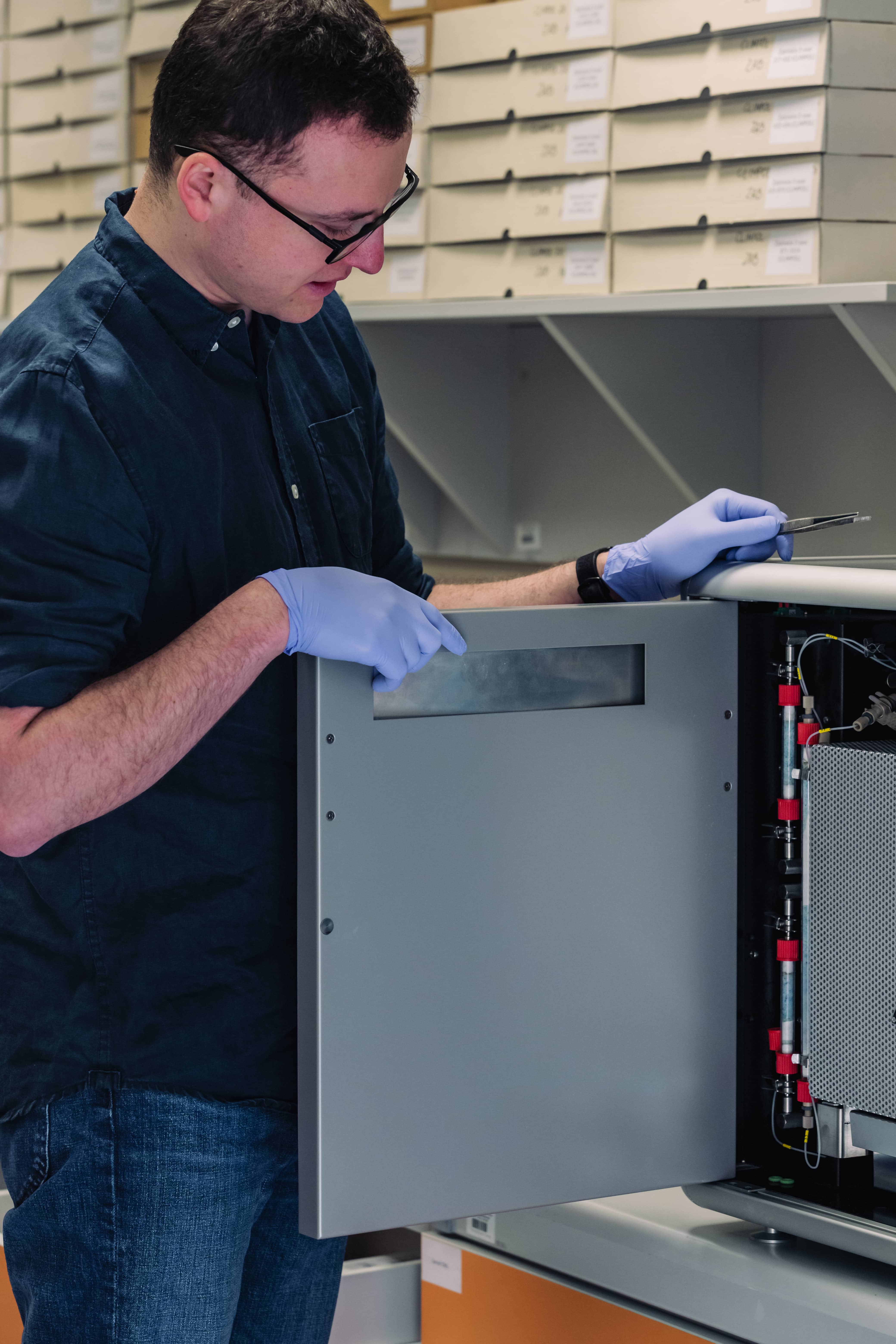
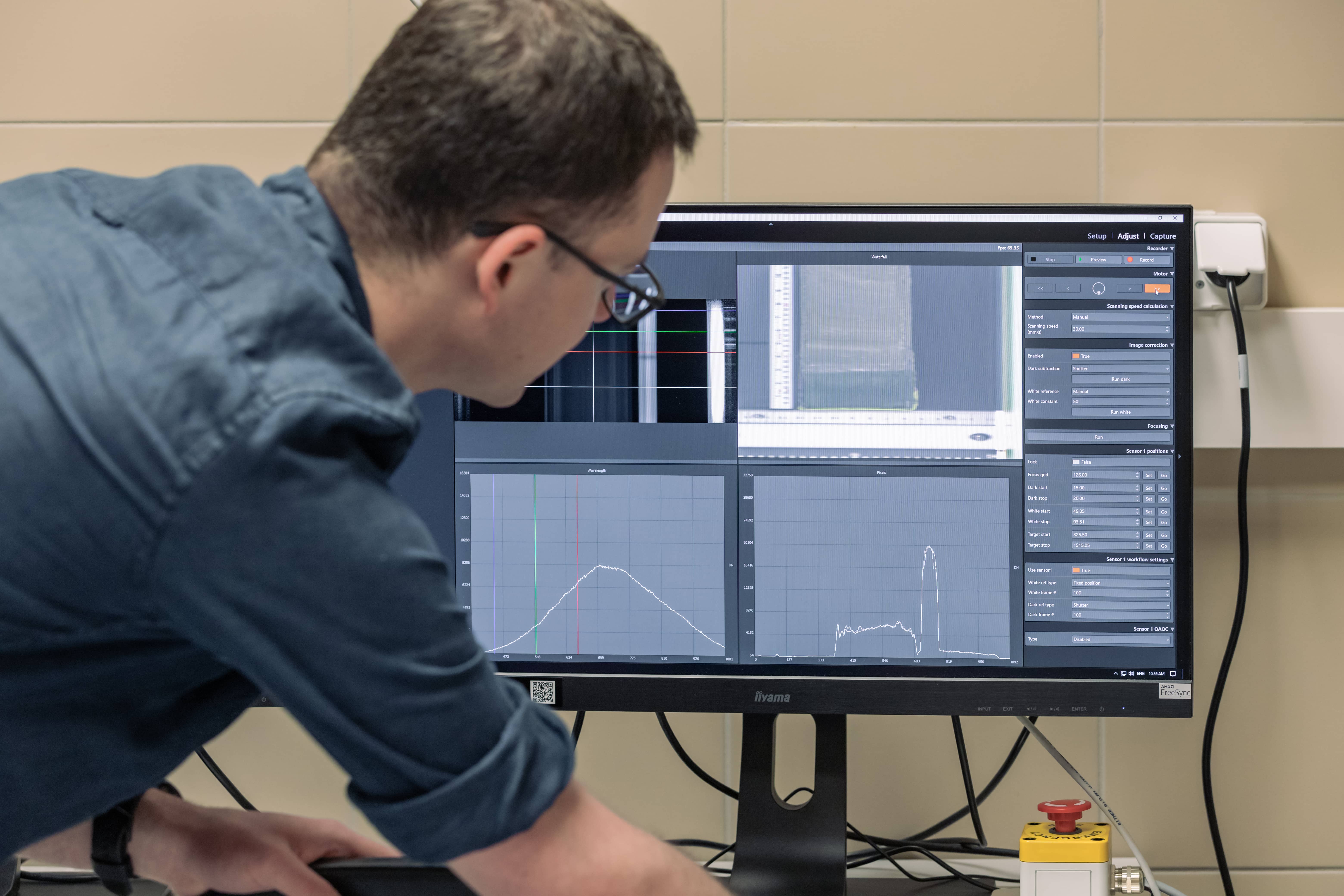
We will be working on material from Arizona. A group of researchers there have already taken a core of sediments from Lake Stoneman, a total of almost 90 m of continuous archive of environmental changes. Such a long borehole is quite a logistical and technological challenge. The search for new variables informing about the environmental past, 'proxy' data (intermediate data) is one of the things I intend to do on this material. 1.3 million years is a completely new and foreign time perspective for me until now I have worked with sediments that were formed after the last glaciation. Such a long perspective is an opportunity to trace what happened during previous glaciations and during the warm periods that separate them. My research will mainly make use of the hyperspectral scanner and the vast amounts of data it generates.
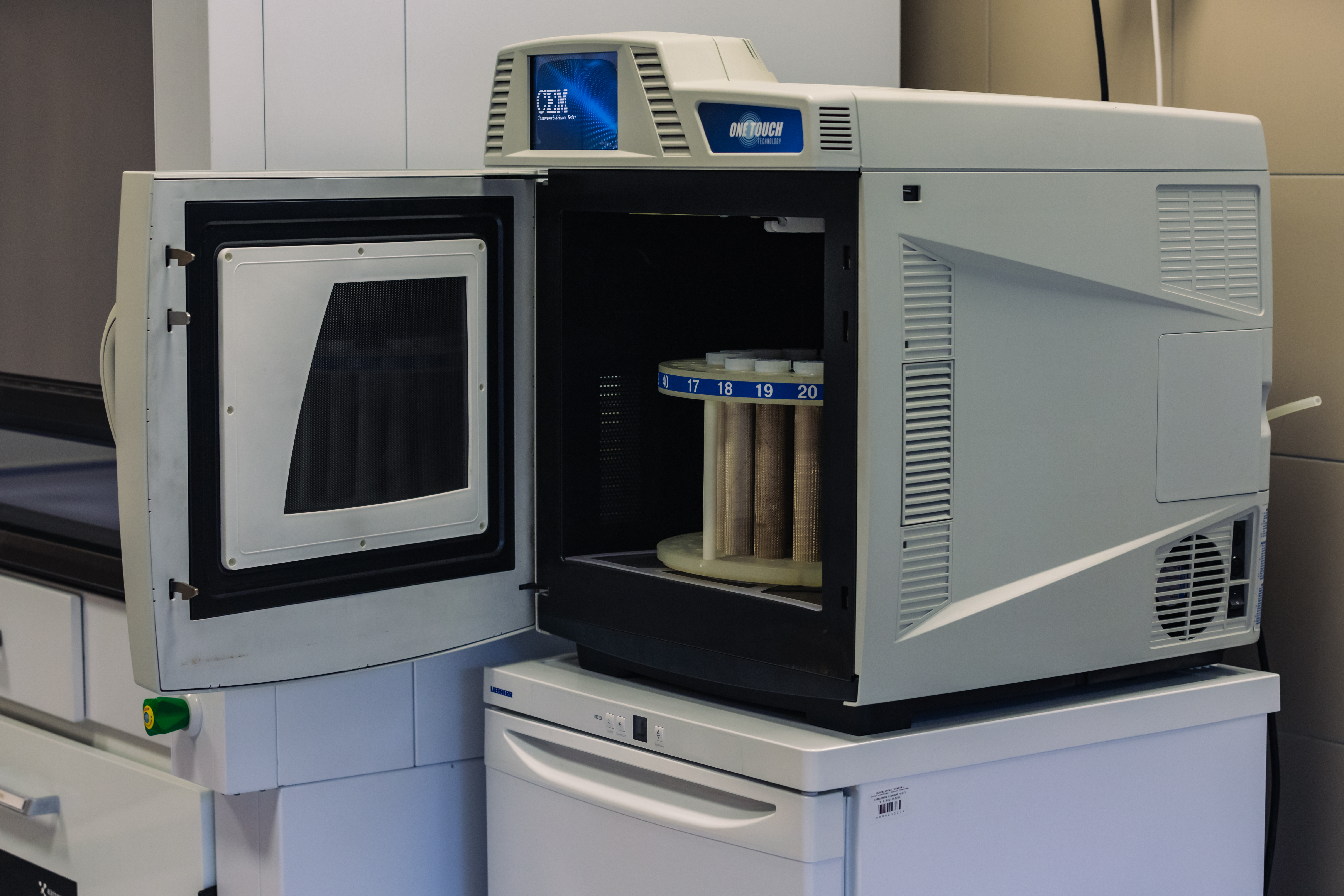
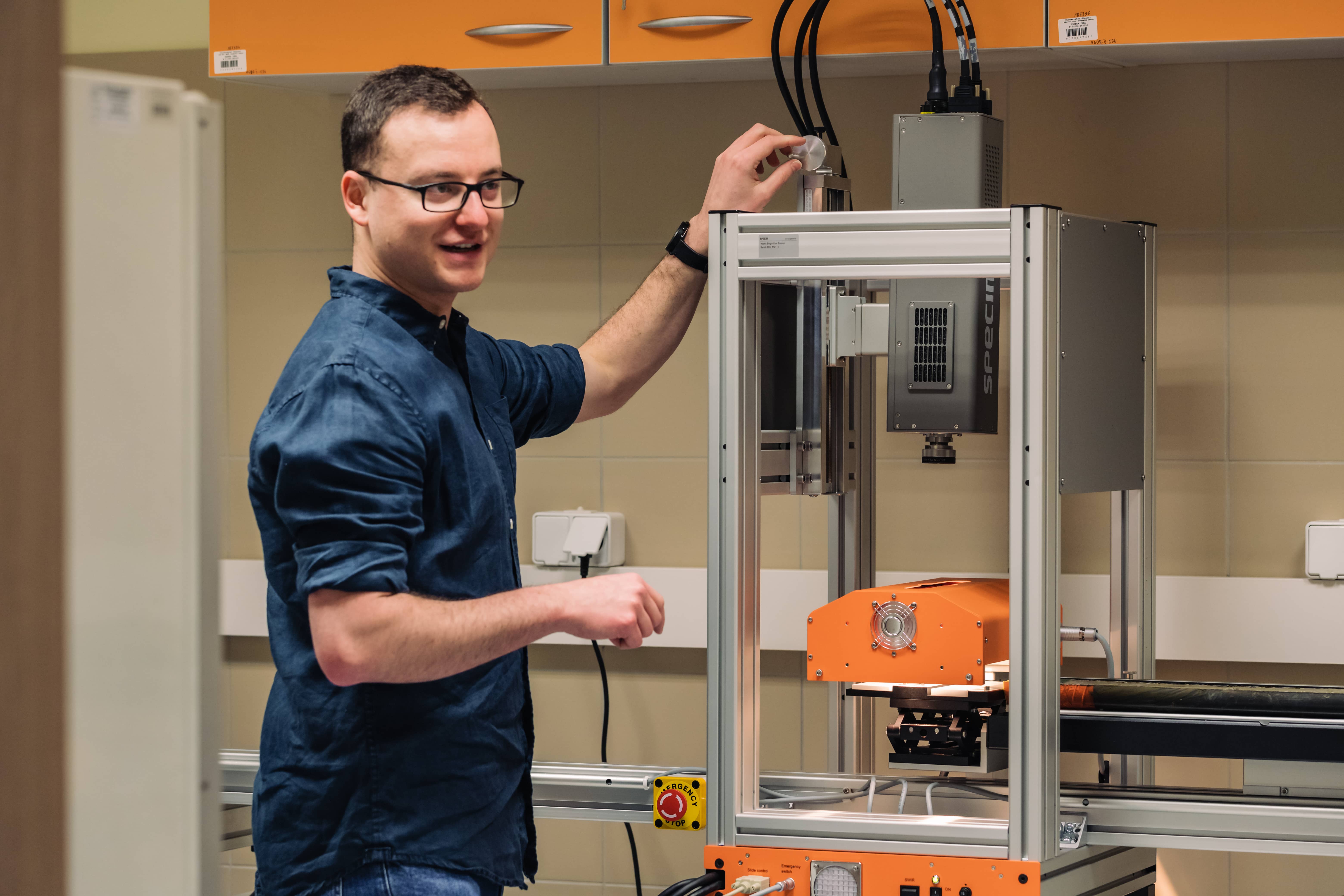
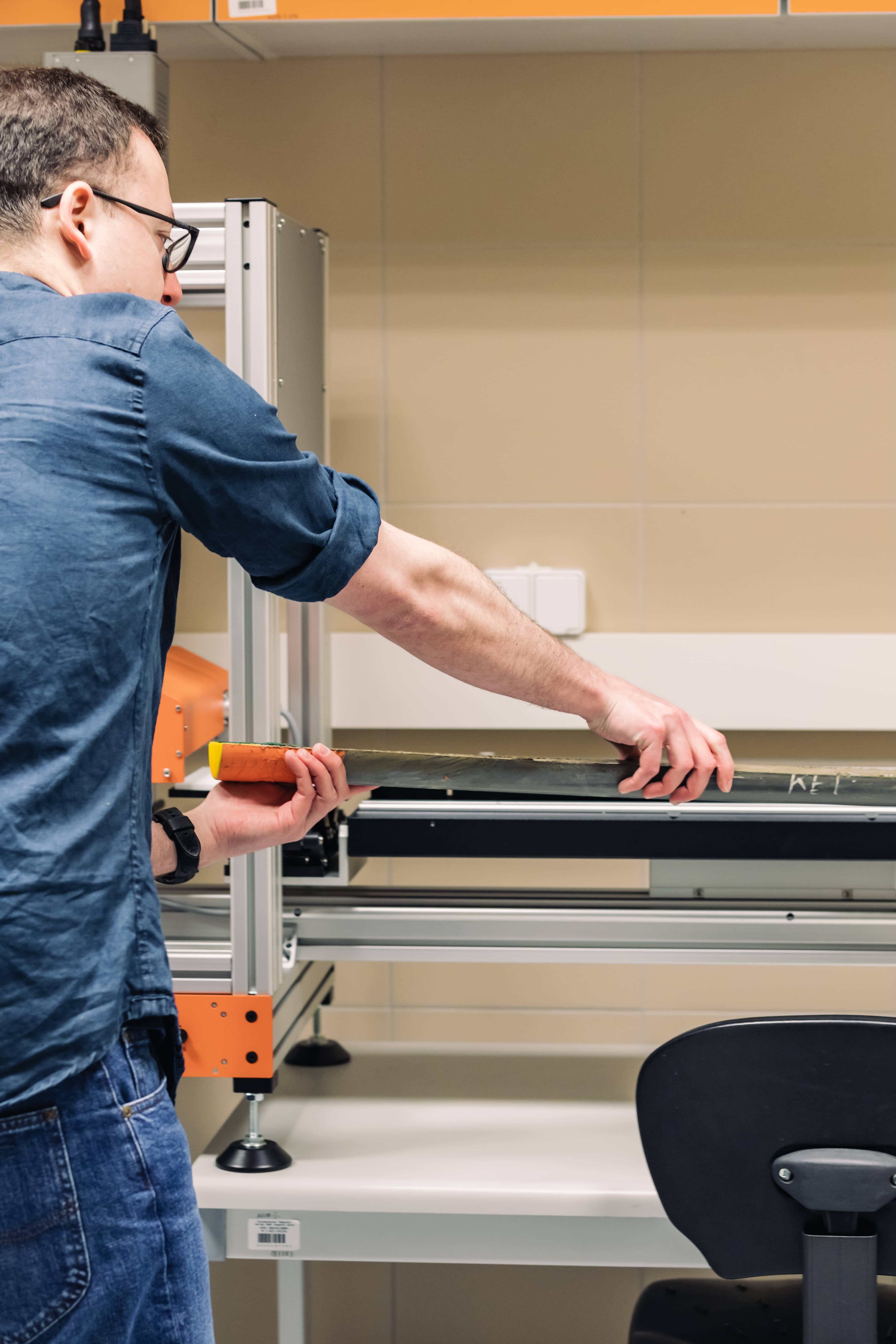
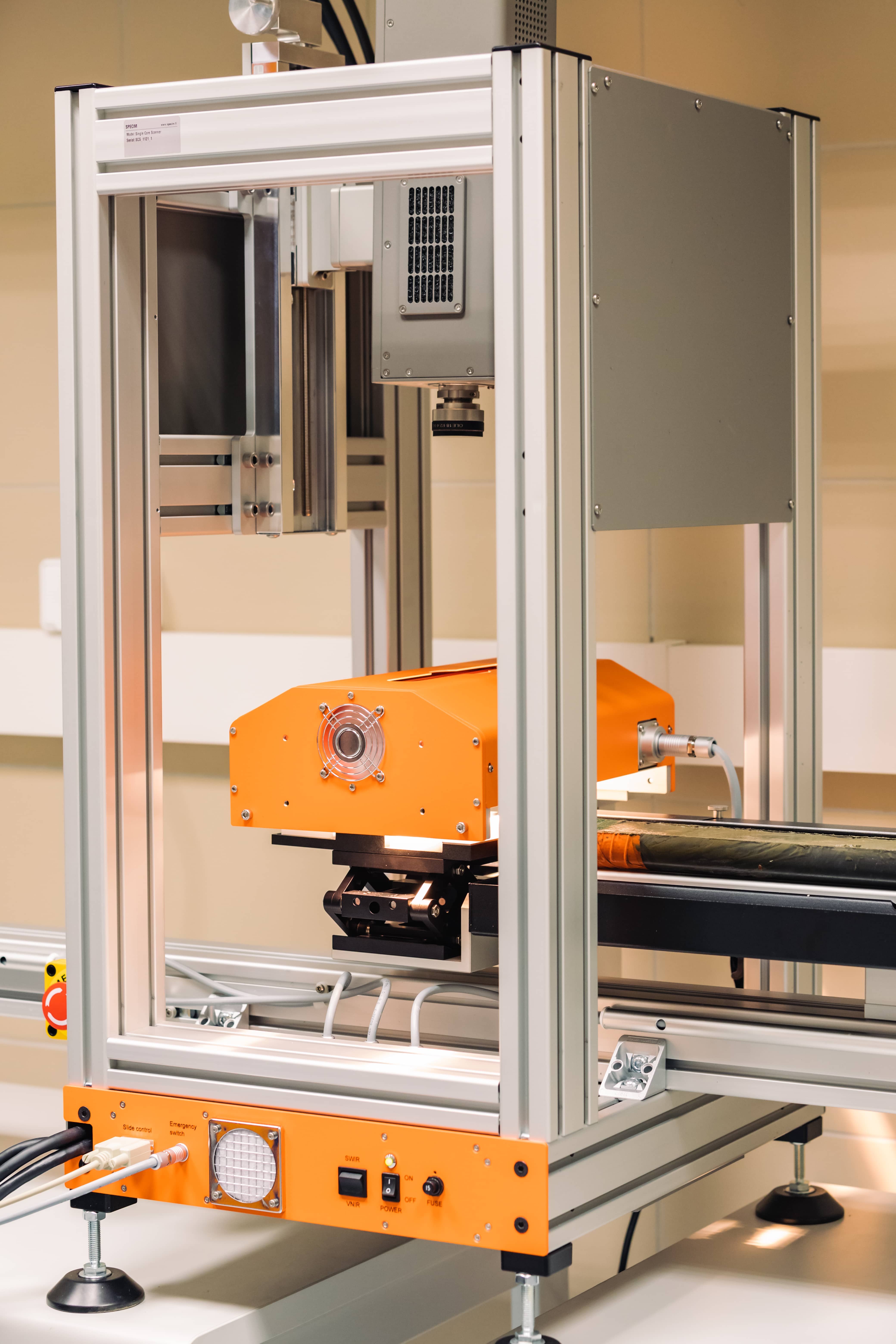
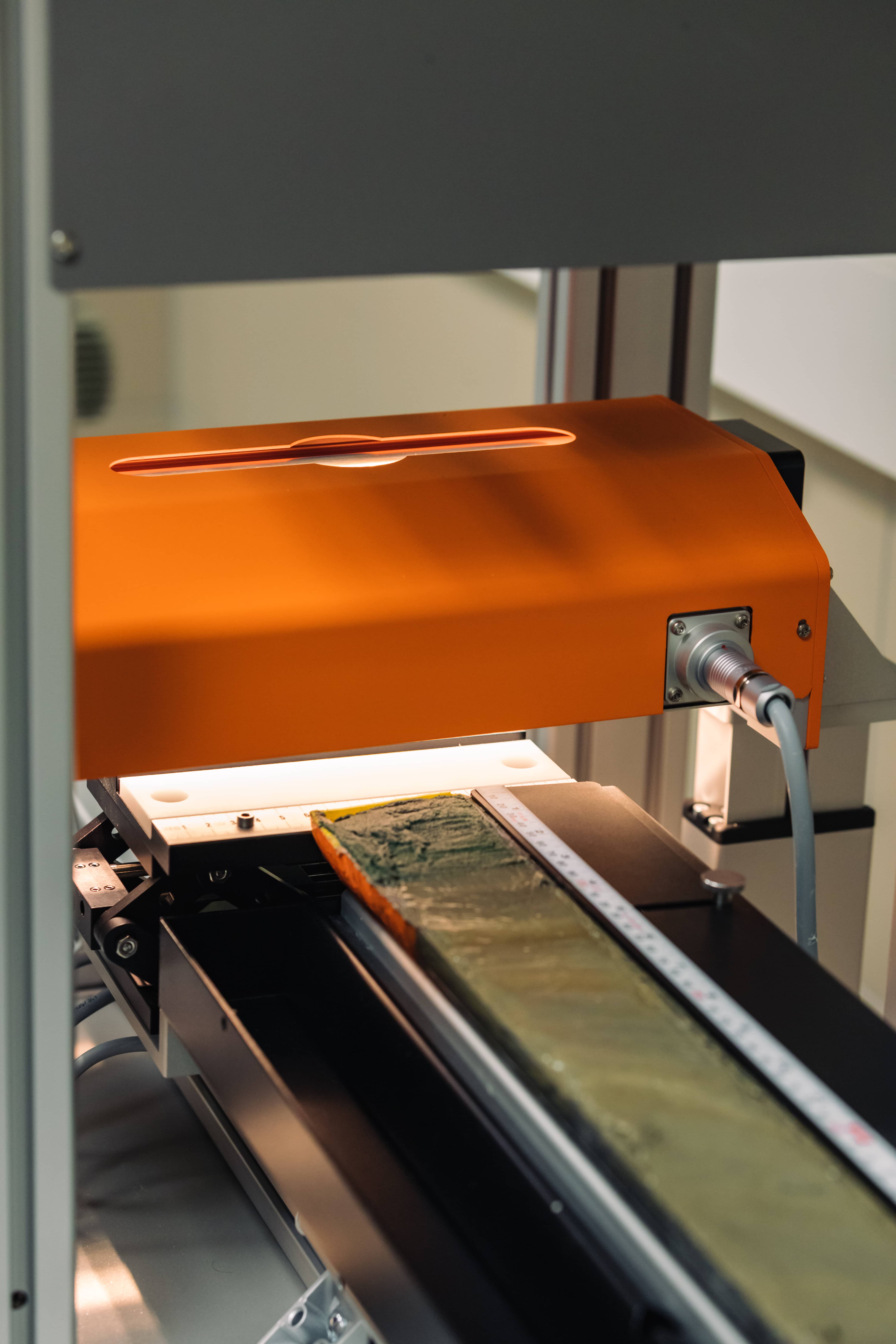
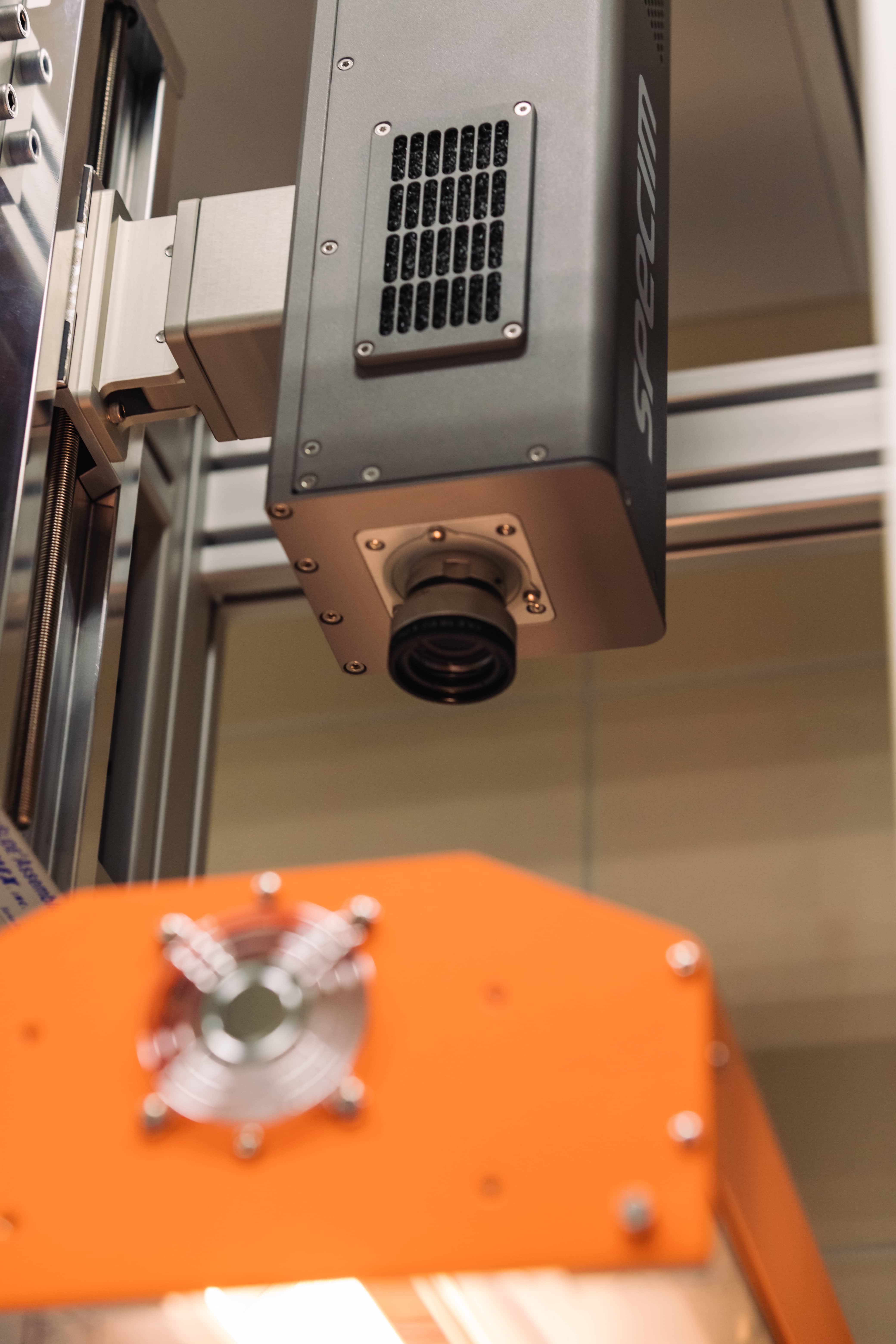
- The scanner for hyperspectral imaging of geological sediment cores, the same one that the Department of Oceanography and Geography of the University of Gdańsk recently received under an NCN Opus grant? This is supposedly a unique device, possessed by only about 10 research and scientific centres in the world. In Poland, we are the only ones to have it. So you will also learn how to use it in the USA?
- This is exactly the plan. This equipment gives incredible possibilities. It is used for hyperspectral imaging of sediments. The hyperspectral camera installed in it is very accurate, 'sees' much more 'light' than we do and collects more information about the observed objects. It is like a camera on legal doping. The camera looks at the whole surface of the sample and creates a map, a picture with very many bands (of electromagnetic radiation). Normally when we think of a photograph we think of something described by three channels - red, green and blue. A hyperspectral camera registers almost 800 such channels. Imagine also that the scanner takes several dozen measurements in a millimetre of the core. At each of these points at the same time, it determines how many 'products' of various organisms are present, or what minerals build it and how large the various sediment components are. This is a wealth of information that informs us about the past.
- You talk about it with great passion. Finally, tell us how did you end up at the Faculty of Oceanography and Geography of UG?
The physical part of geography has always attracted and interested me a lot. As a child, of course, I liked dinosaurs! But I didn't become a palaeontologist. In secondary school, at that strange age for a human being, I mostly became animated when there was talk of processes shaping our planet. Already then I knew I wanted to study geography, although I wasn't sure which university to choose. Tri-City won out. Even though this subject might not seem very promising to many people, I think it's worth being curious about the world and developing your curiosity. Let's not be afraid of it.