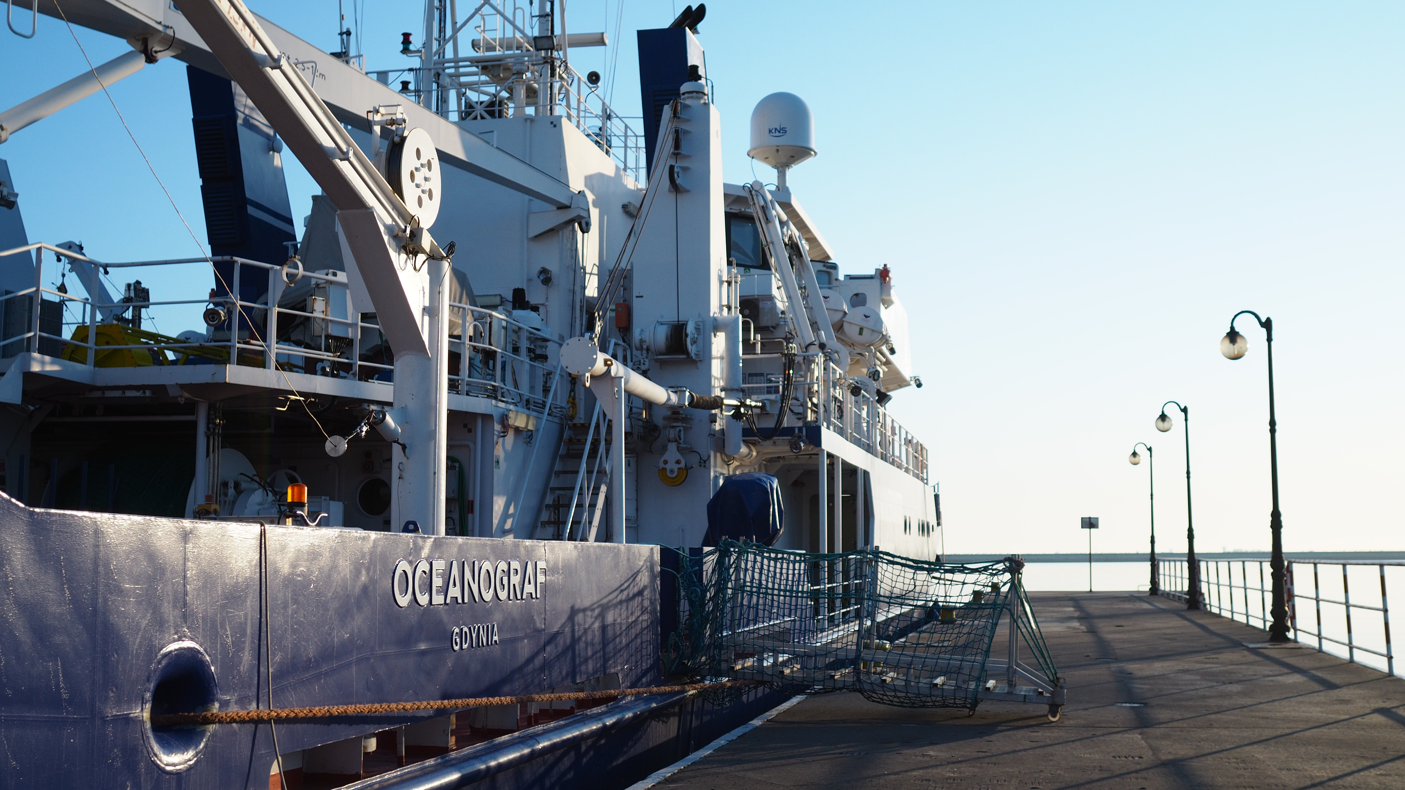
Once again a research vessel from the University of Gdańsk has set out to sea. This time the 'Oceanograf' was mapping the Baltic seabed with a sonar to see if it was a suitable place to store historic shipwrecks. On board were representatives of the Maritime Museum in Gdańsk, UG researchers, as well as students.
As of 2019, the 'Oceanograf' serves as a research unit of the Institute of Oceanography UG. Various external institutions benefit from the capabilities of this unique vessel.
- 'These include companies as well as universities. Thanks to these agreements, our ship goes to sea practically every day. There are rare days when it stays in port,' said Filip Dąbrowski, an employee of the Office of Maritime Infrastructure at the UG.
prof. Leszek Łęczyński, Iwona Pomian, dr Jakub Idczak
At the beginning of March, as part of the official cooperation between the National Maritime Museum in Gdansk and the UG, the 'Oceanograf' set off to explore a designated area of the Baltic Sea. - 'The idea is to secure the area so that archaeological artefacts can be transported there. New maritime investments often force us to move underwater ships that have historical value,' explains Iwona Pomian, Representative of the Director of the National Maritime Museum in Gdańsk for the Protection of Maritime Cultural Heritage. - 'The first ship we repositioned was the Swedish galleon "Solen", as it was threatened by other ships leaving their anchors where it lay. The second ship, the "Miedziowiec" was excavated years later and preserved in the workshop.'
On the first day of the survey, divers fished out pieces of wood that were placed in the sea to test the potential effects of the marine environment on the ship's hull. This is just one of many tests that needs to be carried out to thoroughly investigate the specifics of a marine area.
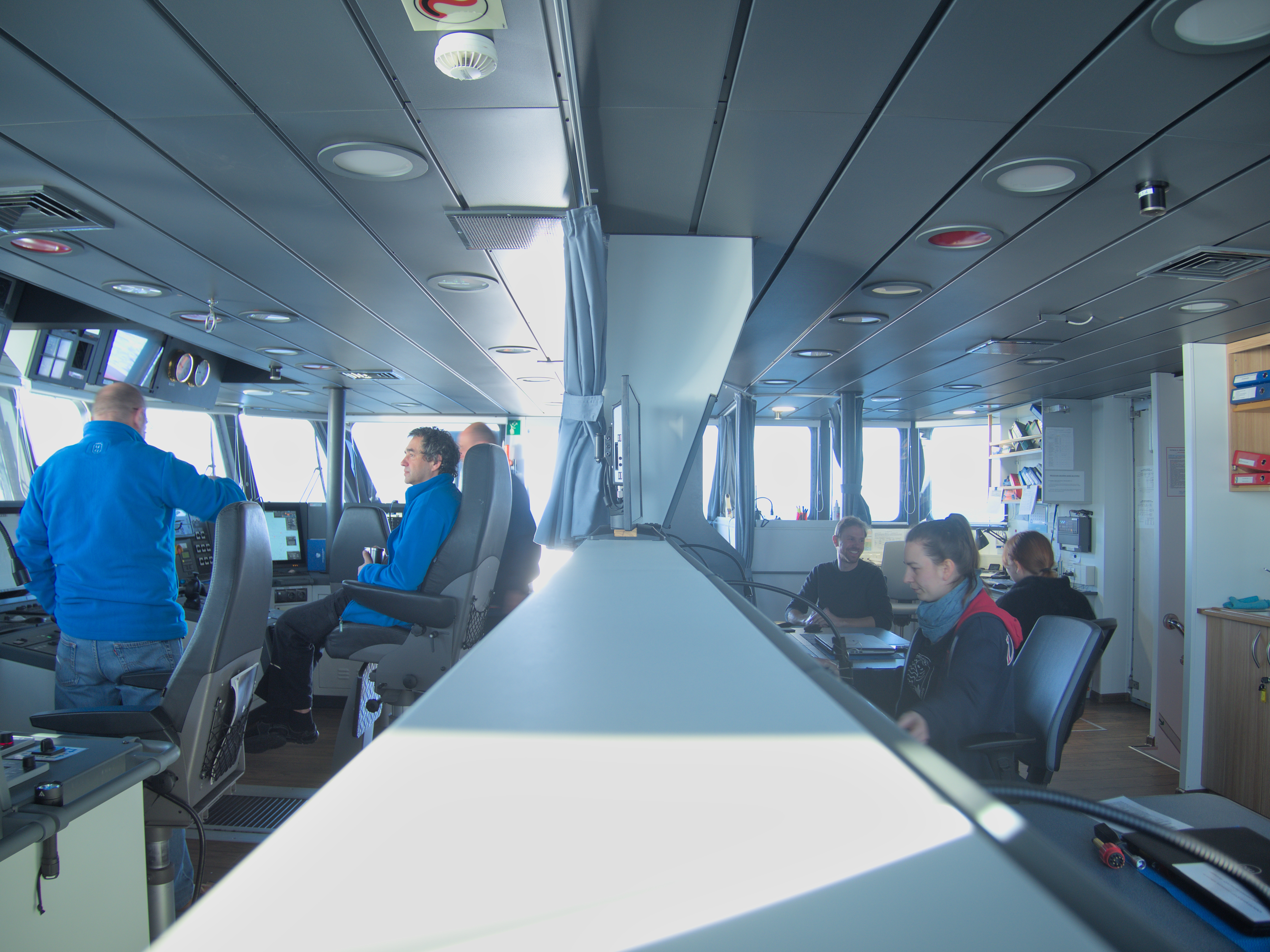
- 'I need to find out the nature of the seabed, its forms and make a statement on lithodynamic processes that may cause the sculpture of the sea bed to transform,' - explains the expedition leader dr hab. Leszek Łęczyński, prof. UG. - 'For these studies, we use, among others, a sub-bottom profiler and a multibeam echo sounder. Today we are using the latter.'
mgr Karolina Trzcińska, Aleksandra Malecha
During the cruise, dr Jakub Idczak from the Remote Sensing and Spatial Analysis Laboratory, mgr Karolina Trzcińska, a doctoral student in the Department of Geophysics, and Aleksandra Malecha, a fifth-year student of oceanography, worked on the device that reads the sonar signal. - 'There are many types of sediment on the seabed, e.g. sand, boulders or barnacles. My job is, among others, to determine by means of hydroacoustic measurements where marine habitats occur,' said mgr Karolina Trzcińska.
Her specialisation is different from the subject of research carried out for the Maritime Museum in Gdańsk. However, this does not mean complete exclusion from the project. Thanks to her good knowledge of the equipment, mgr Karolina Trzcińska helps to operate the echo sounder. - 'Oceanography is very interdisciplinary. One piece of equipment is used for many different measurements. Thanks to the fact that we know how to use a multibeam echo sounder, we can see wrecks, the shape of the bottom, fish in the water, and Ms Karolina can see what type of sediment we have,' says Aleksandra Malecha.
The student is currently finishing her master's thesis. Participation in such research helps her gain the experience necessary for future projects. I get to know the equipment and practice using it. When I'll be looking for a job, the experience gained here will be very useful - adds Aleksandra Malecha.
According to members of the research team, it will take more than 24 hours to fully map the bottom of the basin. This will probably not be the last of such voyages. Currently, the monuments of the Maritime Museum have to be relocated due to the expansion of the Port of Gdańsk. Soon, our coast awaits various other investments connected, for example, with an agreement on offshore wind energy.
'Oceanograf' mapping the seabed using the software.